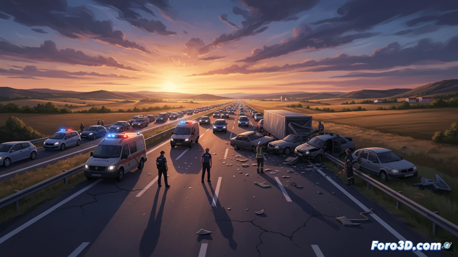
Last April 30, an accident at kilometer 34 of the A-42, near Illescas (Toledo), forced the closure of the right lane and generated traffic jams of up to 10 kilometers. Fortunately, no serious injuries were confirmed, but the scene was marked by scattered debris and the complex positioning of the vehicles. For experts, documenting this type of incident with millimeter precision is the first step to understanding the dynamics of the impact.
Digital twin of the roadway: Technical capture process 🛰️
The documentation of the scene was approached through a dual workflow. On one hand, a terrestrial LiDAR scanner was deployed, capable of recording the geometry of the roadway, horizontal signage, and deformations of the New Jersey barriers with a point density of 1 mm. In parallel, a drone flight equipped with a 50 MP camera was conducted to capture 180 zenithal and oblique images. These photographs were processed using Structure from Motion (SfM) photogrammetry, generating a dense point cloud and a georeferenced orthomosaic. The fusion of both datasets in forensic analysis software allowed the creation of an exact digital twin, where every piece of plastic debris and every skid mark was indexed in absolute coordinates.
Data objectivity vs. witness memory 🧠
3D recreation allows forensic engineers to simulate the trajectory of vehicles seconds before impact. By calibrating the friction coefficients of the A-42 and applying energy conservation models on the digital twin, collision speeds can be calculated without relying on subjective testimonies. In this case, the analysis of damage vectors and the final position of the cars suggests a rear-end collision with lateral displacement. Technology not only documents the chaos but transforms it into an immutable file for the objective determination of responsibilities.
Would you combine scanning with photogrammetry? 🚗