On April 30, an accident on the A-31 near Monforte del Cid (Alicante) caused significant traffic jams and slow-moving traffic for hours. Fortunately, no serious injuries or fatalities were reported. However, this type of incident is ideal for applying advanced forensic documentation techniques. At Foro3D, we analyze how 3D technology allows the scene to be reconstructed to clarify the causes of the impact and the dynamics of the collapsed traffic.
Photogrammetry and LiDAR for trajectory analysis 🚗
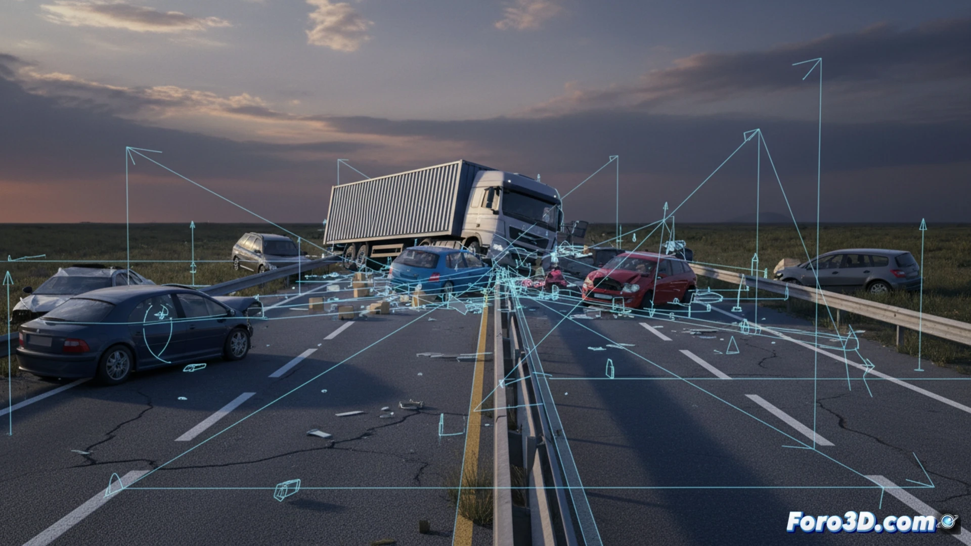
Documenting an accident like the one on the A-31 begins with on-site data capture. Using digital photogrammetry, dozens of high-resolution images are taken from different angles, covering both the vehicles involved and the roadway and signage. Additionally, a LiDAR scanner generates a millimeter-precise point cloud of the environment, recording the final position of each object. This 3D model allows investigators to measure braking distances, calculate vector velocities, and simulate pre-impact trajectories, all without relying on subjective testimonies.
Lessons for road safety from the digital model 🛡️
Beyond determining responsibility, the 3D reconstruction of this accident on the A-31 offers a valuable preventive tool. By analyzing the road geometry, curvature radii, and actual visibility at the time of the accident, engineers can identify black spots or deficiencies in drainage and pavement. The digital model thus becomes a virtual laboratory to test improvements, such as installing dynamic barriers or relocating signs, reducing the likelihood of future traffic jams and collisions on this stretch in Alicante.
Would you combine scanning with photogrammetry? 🔍