On May 1st, a hiker died after falling into the Genil River in Güéjar Sierra, Granada. This tragic event, which occurred in a difficult-to-access area, presents a challenge for investigators. The documentation and virtual reconstruction of the scene using 3D technologies become key tools to clarify the dynamics of the accident without altering the original location.
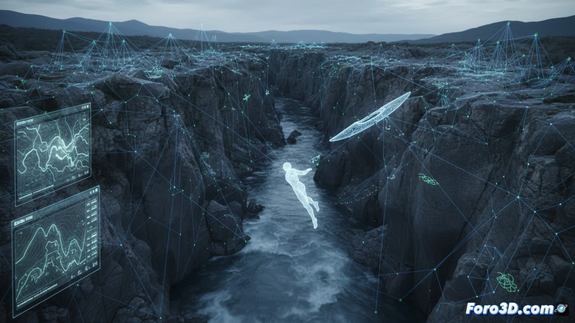
Aerial photogrammetry and LiDAR for capturing the riverbed 🚁
The process begins with a drone flight equipped with a high-resolution camera to capture hundreds of images of the ravine and the fall trajectory. These are processed using photogrammetry software to generate a textured 3D model of the terrain. Simultaneously, a terrestrial LiDAR scanner captures the exact morphology of the riverbed, rocks, and slopes, recording millions of points with millimeter precision. This data allows for calculating slope angles, identifying slip points, and simulating water flow at the time of the incident.
The virtual scene as an immutable witness 🧊
By merging both data sets, a digital twin of the accident is obtained. Investigators can virtually tour the location, measure distances, and analyze factors such as ground moisture or rock stability from the safety of a laboratory. This methodology avoids scene contamination and allows forensic experts to focus on the mechanical causes of the incident, whether a slip or a geological failure, without premature speculation.
Is it possible to determine the exact speed and trajectory of a fall in a natural environment like the Genil River through photogrammetric analysis of witness and drone images, and how does the precision of 3D models influence the forensic reconstruction of the accident?
(PS: In scene analysis, each scale witness is a small anonymous hero.)