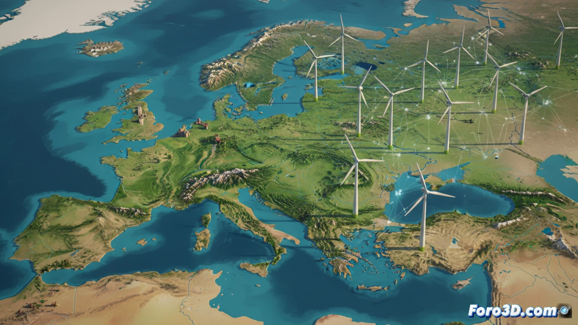
Researchers from the Swiss Federal Institute of Technology Zurich (ETH) and the Paul Scherrer Institute (PSI) have developed the first European landscape quality map using artificial intelligence. The study, which analyzes the tension between the expansion of wind farms and the conservation of scenic environments, processed over 200,000 user-rated images in Great Britain to train a machine learning model capable of identifying the factors that define natural beauty.
Machine learning and geospatial data visualization 🌍
The AI model identified key patterns such as glacial and rocky terrain, proximity to water bodies, and the presence of sunlight as determining elements of visual appeal. The data was integrated into a geographic information system (GIS) to generate an interactive three-dimensional map of Europe. This representation allows for overlaying data layers: on one hand, areas of high scenic value, and on the other, optimal areas for wind turbine installation based on technical criteria such as wind speed and accessibility. The result is a scientific visualization tool that graphically exposes points of territorial conflict.
The dilemma of the energy transition in 3D ⚡
By overlaying both data layers in the 3D model, the researchers observed that many regions of high landscape quality coincide with ideal locations for wind turbines. This visualization not only quantifies the conflict but makes it tangible for urban planners and ecologists. The map thus becomes a dissemination resource that helps understand the complexity of combining energy sustainability with aesthetic preservation, offering a visual basis for informed debates on territorial planning.
What 3D visualization techniques did the ETH and PSI researchers use to represent the conflict between the visual impact of wind farms and the conservation of natural landscapes in their map of Europe?
(PS: fluid physics for simulating the ocean is like the sea: unpredictable and you always run out of RAM)