At 87 meters deep in the Baltic Sea lies a 60-meter diameter structure that has baffled oceanographers since 2011. Known as the Baltic Anomaly, this circular formation features straight edges, a concrete-like surface, and strange formations that resemble stairs. The most unsettling aspect for diving teams is that, upon approaching, electronic devices and underwater cameras suffer inexplicable electrical interference, shutting down or distorting signals.
Underwater Photogrammetry and Volumetric Reconstruction 🤿
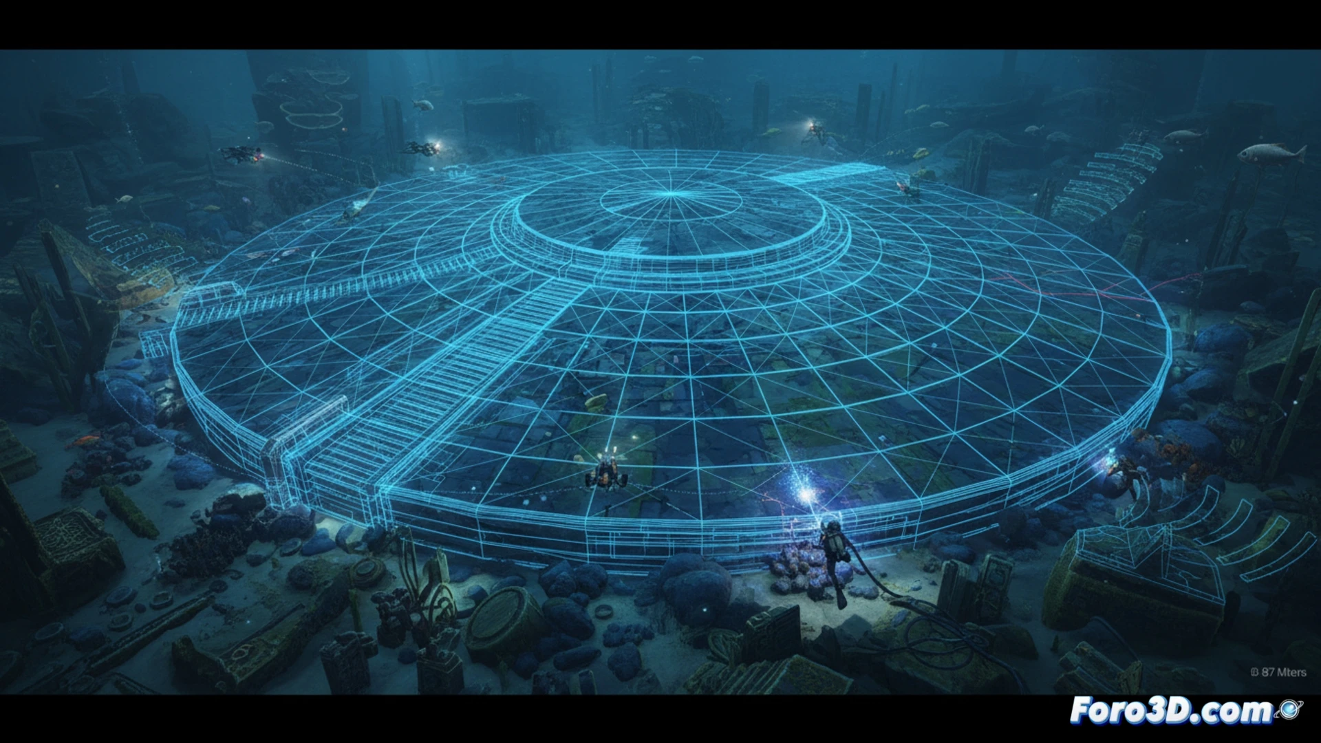
The main difficulty in studying this anomaly is the lack of visibility and the electromagnetic interference that prevents the use of conventional side-scan sonar. To overcome this obstacle, digital archaeology proposes a workflow based on photogrammetry with low-frequency pulsed LED lighting, thus avoiding sensor interference. An ROV equipped with high-sensitivity stereo cameras would capture thousands of images in a grid pattern. Subsequently, Structure from Motion (SfM) software such as Agisoft Metashape or RealityCapture would align the images to generate a dense point cloud. The result is a high-resolution textured 3D model that allows measuring the supposed stairs and the central disk with millimeter precision, without physically touching the structure.
Modern myth or submerged heritage? 🏛️
The digital model not only serves for dissemination on platforms like Sketchfab but also allows geologists to apply structural analysis filters. By comparing the model's topography with databases of glacial formations or manganese nodules, it can be determined whether the anomaly is a natural geological rarity or an artificial construction. If its anthropogenic origin is confirmed, the 3D model would become the first digital conservation record of a possible submerged archaeological heritage, preserving its current state before Baltic currents degrade it forever.
Considering the technical limitations of the side-scan sonar used in 2011, what level of detail and resolution can a modern underwater LiDAR scanner achieve to discern whether the Baltic Anomaly is a natural geological formation or an artificial structure?
(PS: If you dig at a site and find a USB drive, don't plug it in: it could be Roman malware.)