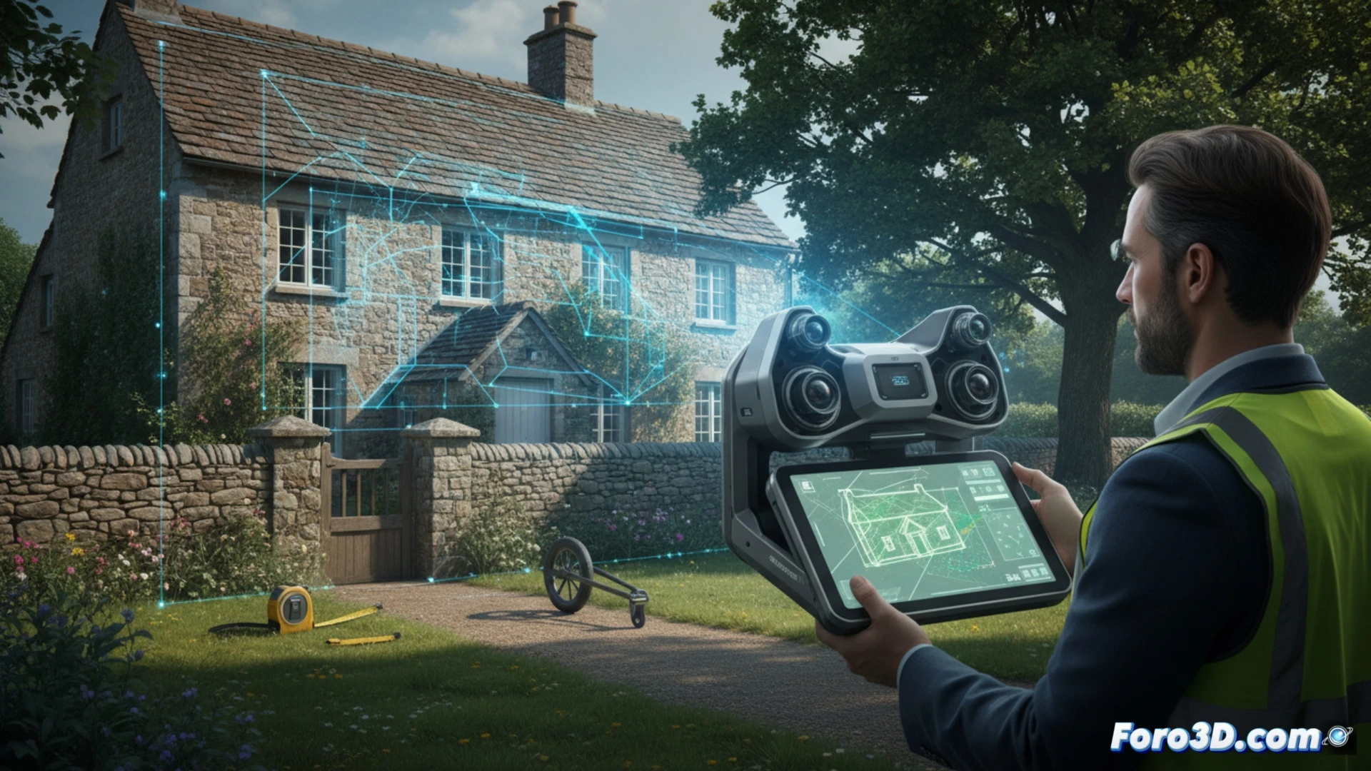
The profession of Property Registrar faces a constant challenge: verifying that what is described in a deed matches the physical reality. 3D technology allows capturing the geometry of a property with millimeter precision, eliminating doubts about boundaries or square meters. A clear example: a portable laser scanner generates a point cloud that can be directly compared with the cadastral map in minutes.
Digital workflow with modeling software 🖥️
To implement this solution, the registrar needs programs like Autodesk ReCap to process point clouds and Fusion 360 to generate accurate BIM models. The process begins with an on-site scan that takes about 15 minutes for a standard home. Data is exported in .RCP or .E57 format and integrated with GIS tools like QGIS. This allows detecting discrepancies between the registered and actual surface area without relying on manual sketches or visual estimates.
When the laser discovers your living room is a storage closet 😂
The biggest joke is told by the scanner when it reveals that the attic you sold as 90 square meters actually has 74 because the builder forgot to include the elevator shaft. The registrar, who previously relied on a measuring tape and good faith, can now prove with a point cloud that the neighbor has stolen half a meter of your terrace. Good thing the software has no sense of humor, because if it could talk, it would be laughing its head off at the sworn statements.