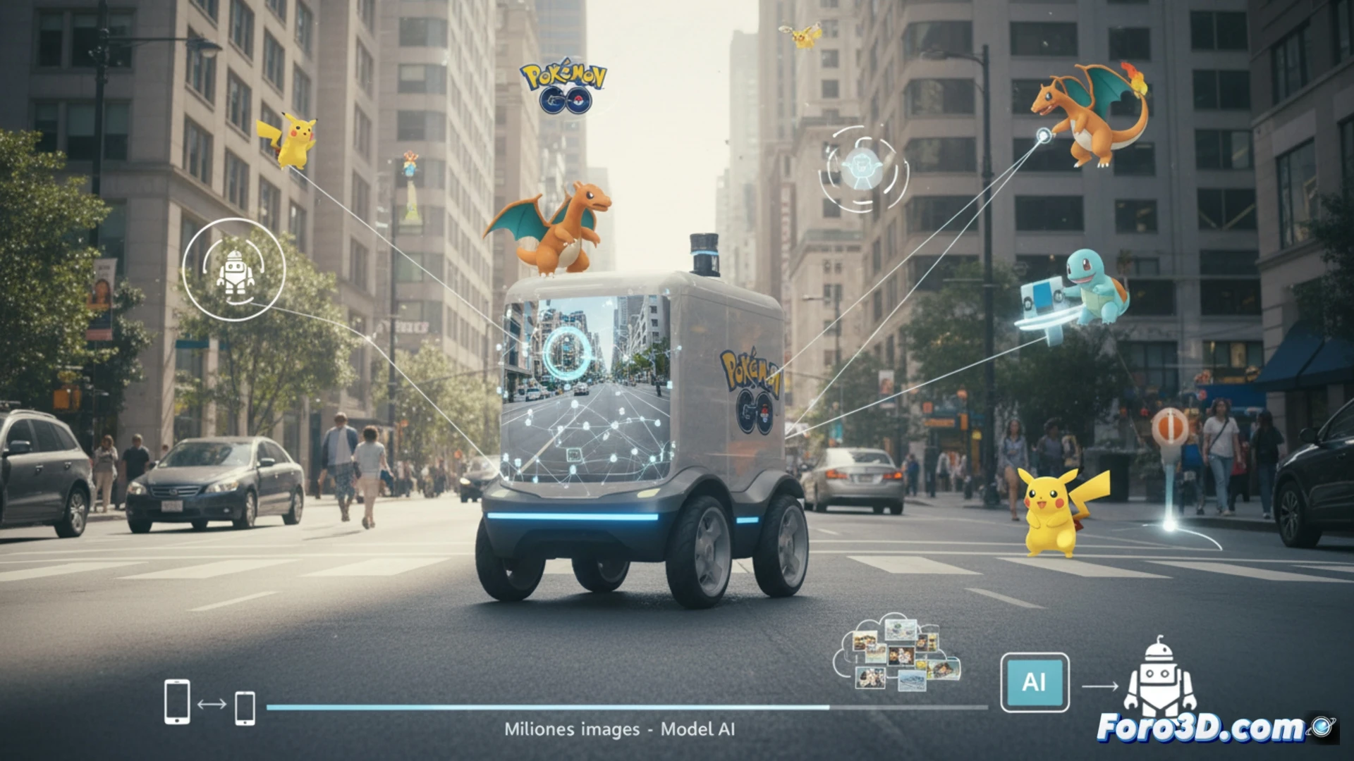
Niantic Spatial, a spin-off of Niantic, is leveraging the immense image bank from Pokémon Go to develop a visual positioning system. With more than 30 billion photos captured by players, they train a model that allows locating oneself with centimeter precision in cities, overcoming the limitations of traditional GPS. This technology, created for AR, is now used in delivery robotics.
From catching Pokémons to mapping streets: the technical functioning 🤖
The system is based on the visual recognition of static landmarks, such as building facades or corners, from geolocated images. Players contribute unknowingly by performing AR mapping tasks in the app. By cross-referencing this data, the algorithm builds a dense visual map that allows a device to calculate its exact position by comparing what its camera sees with the database, useful for autonomous navigation in complex environments.
Your effort hunting Pikachu now guides a delivery robot 🗺️
It's curious to think that those crooked photos you took to catch a Jigglypuff on a streetlamp are now training data so that a robot doesn't crash into that same streetlamp. Players have been doing, unintentionally, the work of a digital surveyor. Maybe in the future, delivery robots will thank you with a beep when you cross paths with them, appreciating your contribution to their sense of orientation.