Contamination of karst aquifers represents a critical challenge due to the high permeability of fractured limestone. In the event of a spill, contaminants move rapidly through conduits and fissures, making traditional monitoring methods insufficient. This article explores how three-dimensional simulation allows visualization of the contamination plume, integrating porosity data and fracture networks to anticipate the advance of the toxic substance toward supply wells.
Construction of the Hydrogeological Model and Flow Simulation 💧
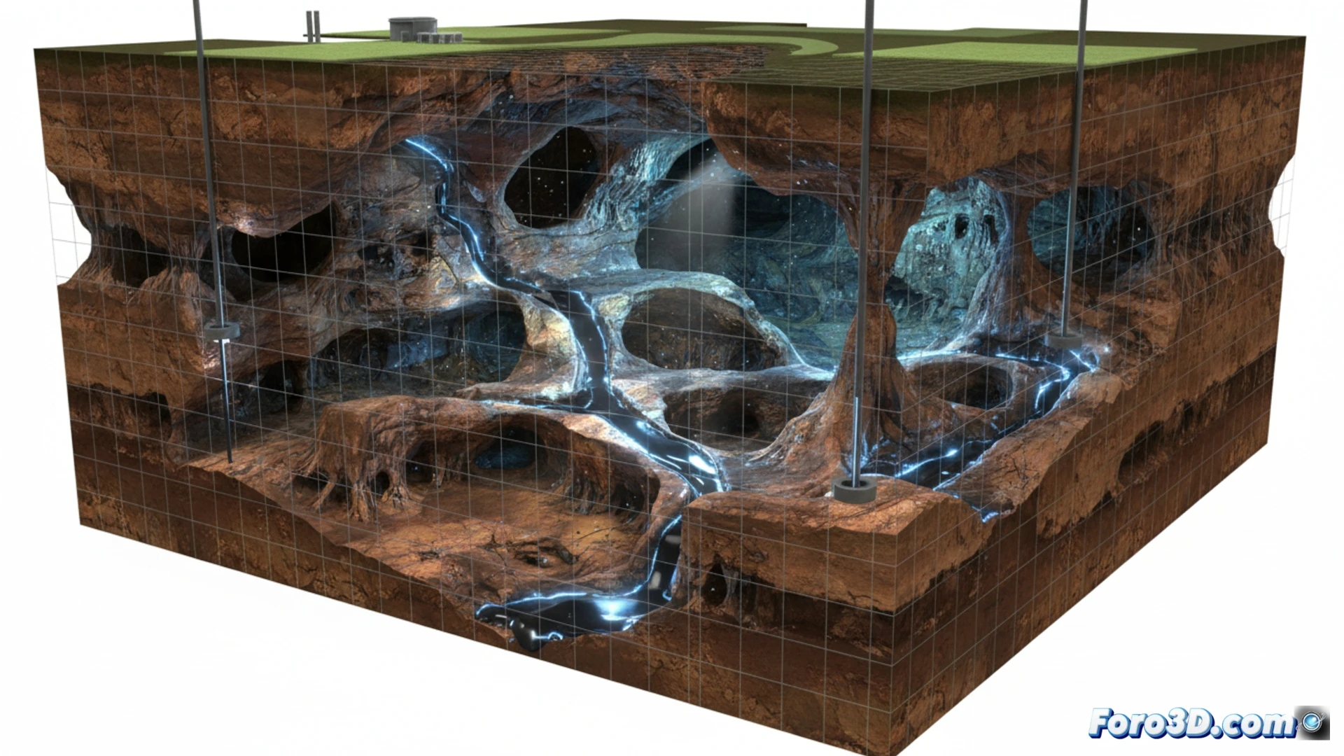
To model the spill, a LIDAR survey of the terrain and data from borehole cores are used. The rock mass is discretized into a finite element mesh that incorporates the porous matrix of the limestone and a discrete fracture network (DFN). Key parameters are hydraulic conductivity (between 10^-4 and 10^-2 m/s in conduits) and secondary porosity. The simulation uses a reactive transport solver to calculate the concentration of the contaminant (e.g., hydrocarbons or leachate) over 90 days. The resulting animation shows how the plume is channeled through preferential pathways, bypassing low-permeability zones and emerging at springs, allowing identification of points for urgent intervention with hydraulic barriers.
Visualization as a Decision and Prevention Tool 🛡️
Beyond graphical realism, the value of this 3D simulation lies in its ability to communicate risks to managers and communities. By overlaying the spill animation on the digital terrain model and well locations, contingency scenarios can be run: vary the pumping rate, modify the location of capture trenches, or evaluate the arrival time of the contaminant front. This approach transforms abstract data into a visual narrative that saves lives and water resources, demonstrating that 3D modeling is indispensable in planning for environmental disasters in karst environments.
How to model in 3D the trajectory of a contaminant in a karst aquifer to predict emergency points and optimize environmental response to a spill
PS: Simulating disasters is fun until the computer crashes and you are the disaster. 😅