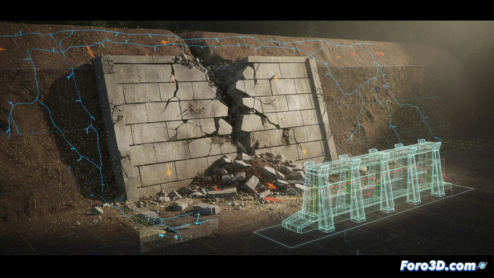
The partial collapse of a 12-meter retaining wall on an urban slope revealed diagonal cracks and slope displacement. Using photogrammetry and laser scanning, the post-failure geometry was captured to reconstruct the 3D model of the damaged state. The analysis identified poor drainage as the main cause, generating excessive hydrostatic pressure and overturning failure. Virtual simulation allowed for evaluating load redistribution.
Capture methodology and structural analysis with polygonal meshes 🏗️
A drone with a 20MP camera was used to generate a point cloud of 2 million vertices, processed in reconstruction software to obtain a high-resolution mesh. The comparison between the original model (based on CAD plans) and the damaged model showed a 4-degree rotation in the upper block and cracks up to 8 cm wide. Finite element analysis on the deformed mesh calculated maximum stresses of 3.2 MPa at the base, exceeding the concrete's strength. A rehabilitation with passive anchors and sub-horizontal drainage was simulated, reducing the stress to 1.1 MPa.
Lessons for virtual reconstruction of ruins 🧩
This case demonstrates that 3D modeling not only documents the disaster but also allows predicting the ruin's behavior under new loads. The virtual reconstruction of the proposed solution integrated the repaired wall with the surrounding terrain, validating long-term stability. For the niche of ruin reconstruction, this methodology offers a replicable workflow: capture, diagnose, and simulate before physically intervening, minimizing risks and costs.
How can differential 3D modeling based on photogrammetry from pre- and post-collapse drone flights accurately identify displacement vectors and residual stresses in a 12-meter retaining wall with diagonal failure to optimize the design of its structural rehabilitation?
(PS: Reconstructing ruins is like doing a puzzle without knowing how many pieces are missing. But at least you can make up the missing ones.)