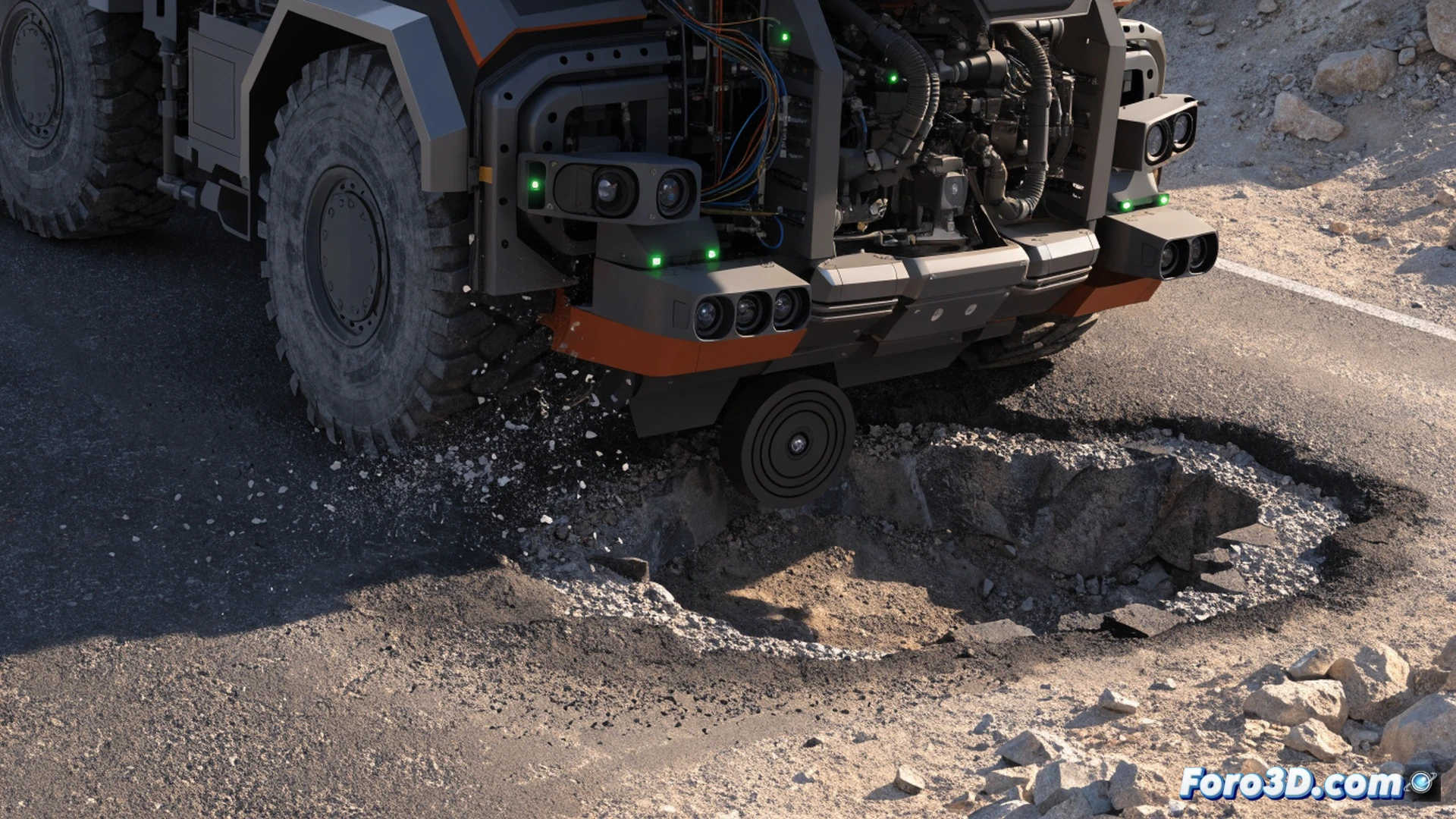
An autonomous mining truck suffered a collision after losing its trajectory due to the miscalibration of the IMU inertial sensor. The incident occurred when it passed over a deep pothole, causing an error in position estimation. To analyze the failure, RealityCapture was used for the 3D reconstruction of the terrain and Carla Simulator to recreate the accident dynamics.
3D Pipeline: reconstruction and simulation of the failure 🚧
With RealityCapture, images of the area were processed to generate a high-precision 3D model of the pothole and its surroundings. This model was imported into Carla Simulator, where the truck's route was reproduced using the IMU data. The simulation confirmed that, after the impact, the inertial sensor delivered erroneous orientation values, deviating the vehicle from its lane. The analysis allowed identifying the vibration threshold that causes the miscalibration.
The pothole that left the truck with existential vertigo 🤖
The IMU, which should know where it is at all times, got disoriented like a tourist without GPS in a wasteland. After the pothole, the sensor decided the ground was somewhere else, and the truck, obediently, went off to explore terrain not planned on the route. At least it didn't ask a rock for directions. Next time, the IMU better have a coffee before starting.