3D Forensic Reconstruction of an Underwater Scene Using Sonar and Photogrammetry
Criminal investigations in aquatic environments pose one of the greatest challenges for experts. Reduced visibility, currents, and the fragility of evidence demand innovative and non-invasive technological solutions. This case explores the process to document a sunken vehicle with human remains, transforming a hostile scenario into an analyzable digital environment through a sophisticated pipeline that fuses acoustic and visual data. 🕵️♂️🌊
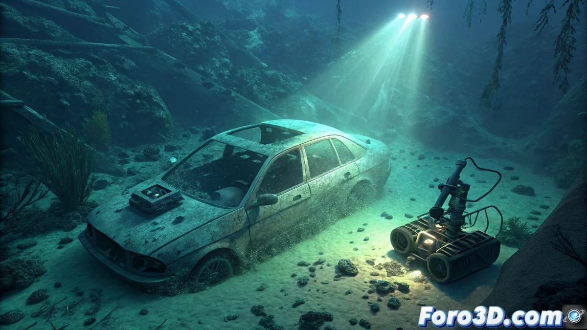
Data Acquisition in a Hostile Environment
The first stage is crucial and is carried out without physical contact with the evidence. To capture the macro-scene, a side-scan sonar is used, mounted on an underwater drone or vessel, which performs methodical passes over the area. This instrument generates a high-resolution acoustic map of the seabed, revealing the exact position of the vehicle, the terrain's geomorphology, and possible drag marks. Sonar data is typically processed in specialized software like SonarWiz. In parallel, a forensic diving team conducts a photogrammetric inspection, capturing thousands of overlapping photographs of the vehicle and its immediate context with cameras calibrated to correct water's optical distortion.
Key Capture Phases:- Acoustic Mapping: Sonar provides the precise geospatial framework and seabed context.
- Detailed Visual Recording: Underwater photogrammetry captures the geometry and texture of objects of interest with millimeter-level detail.
- Environment Preservation: Both methods are completely remote, avoiding any alteration or contamination of the crime scene.
The integration of photogrammetry's visual detail with sonar's positional accuracy is what turns raw data into solid forensic evidence.
Processing and Integration: Building Digital Evidence
With the raw data captured, the digital synthesis phase begins. The massive set of photographs is imported into photogrammetry software like Agisoft Metashape. Here, through computer vision algorithms, the images are aligned and a dense point cloud and textured 3D model of the vehicle are generated. This model, though rich in details, initially lacks scale and absolute georeferencing. The next step is fundamental: in a tool like CloudCompare, the photogrammetric model is aligned, scaled, and fused with the 3D terrain mesh obtained from sonar data. This multimodal data integration creates a unified, accurate model situated in its real context.
Specialized Software Pipeline:- Agisoft Metashape: For photogrammetric reconstruction and generation of the textured mesh from underwater photographs.
- CloudCompare: Acts as the digital "glue," precisely aligning and fusing models from sonar and photogrammetry.
- Blender: Used in the final phase for forensic visualization, artifact cleaning, creation of explanatory animations, and sectioned views that illustrate, for example, the vehicle's entry trajectory into the water.
The Paradox of Underwater Forensic Analysis
The final irony of this meticulous process is profound. To unravel the mysteries of a crime committed in the depths—an opaque, cold, and hard-to-access medium—investigators end up working in an immersive virtual space that is the opposite: clear, dry, and completely controllable. In this digital twin of the scene, experts can "fly" around the evidence, take measurements with millimeter precision, simulate scenarios, and examine details from impossible angles in the real world. This permanent and interactive record not only serves for analysis but also as a powerful courtroom presentation tool, taking the jury to the ocean floor without getting their feet wet. 🔍💻