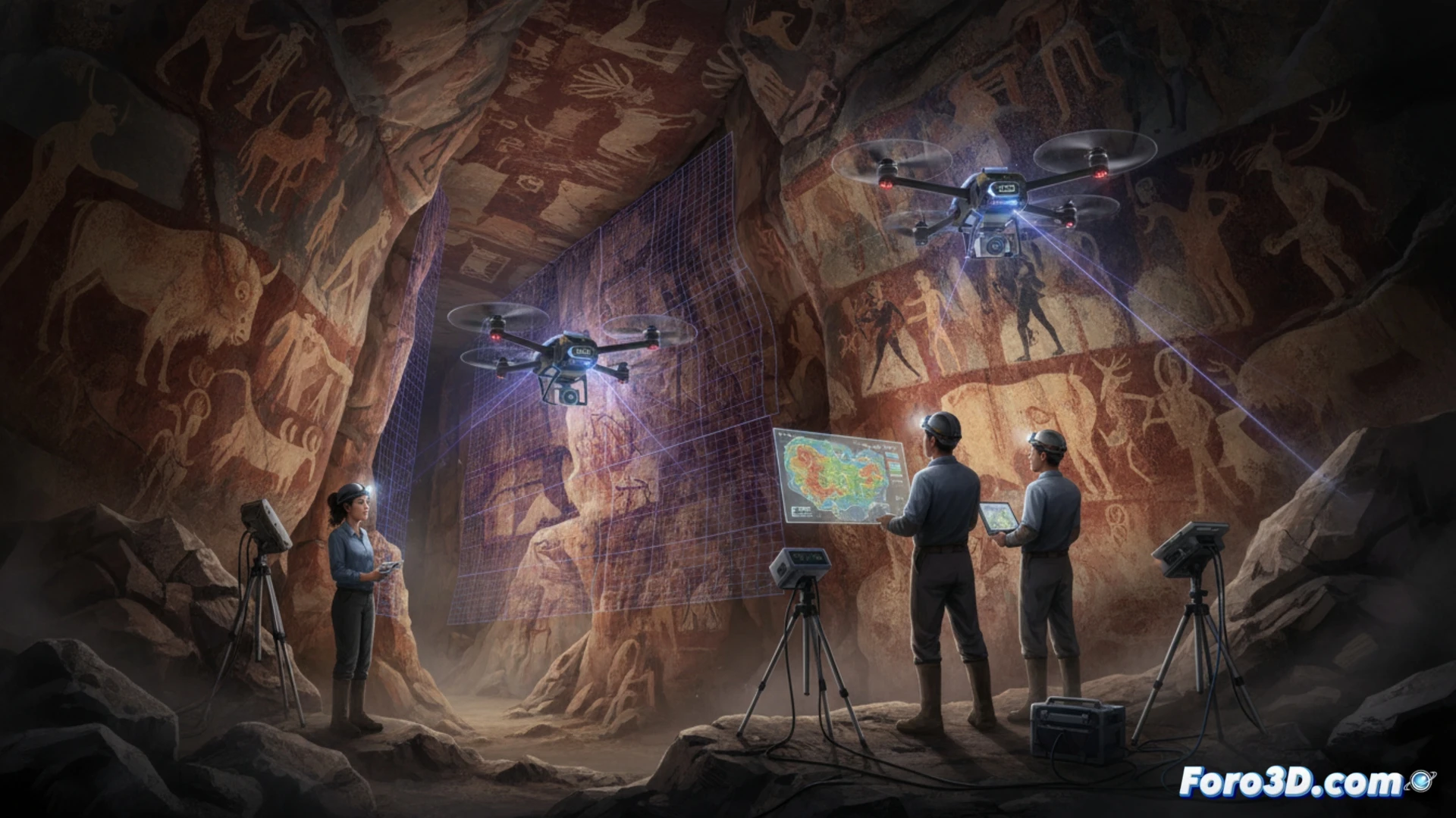
A team from the CSIC and the University of Cantabria has used drones with LIDAR sensors and high-resolution cameras to map the most inaccessible areas of the Altamira cave. The goal is to digitally reconstruct galleries and passageways of this 14,000-year-old Paleolithic site without risking its fragile cave paintings.
LIDAR and photogrammetry to map the underground 🗺️
The drones flew autonomously through sectors where human access is complicated or dangerous. Equipped with LIDAR, they generated point clouds that, combined with high-resolution photogrammetry, allow for precise 3D models of every corner. The result is a digital twin that archaeologists can study without stepping into the cave, thus avoiding altering the humidity or temperature of the environment.
The drone that saw what Neanderthals could not 🤖
While the ancient inhabitants of the cave strained their eyes with grease torches, now a drone with LIDAR maps every crack without needing light. The irony is that the painted bison probably never imagined that, millennia later, a flying robot would be their best bodyguard. Of course, the drone hasn't left a single signature on the wall, something not all tourists can say.