Shepherding, an age-old profession, hides a reality of physical risks that scientific visualization can make tangible. From traveling up to 20 kilometers daily on foot or horseback to constant exposure to uneven terrain, the shepherd's body suffers cumulative wear and tear. Data science and 3D modeling now allow us to simulate these variables, offering a workplace prevention tool that transcends traditional manuals.
LIDAR Modeling and Physical Fatigue Simulation in Rural Environments 🐑
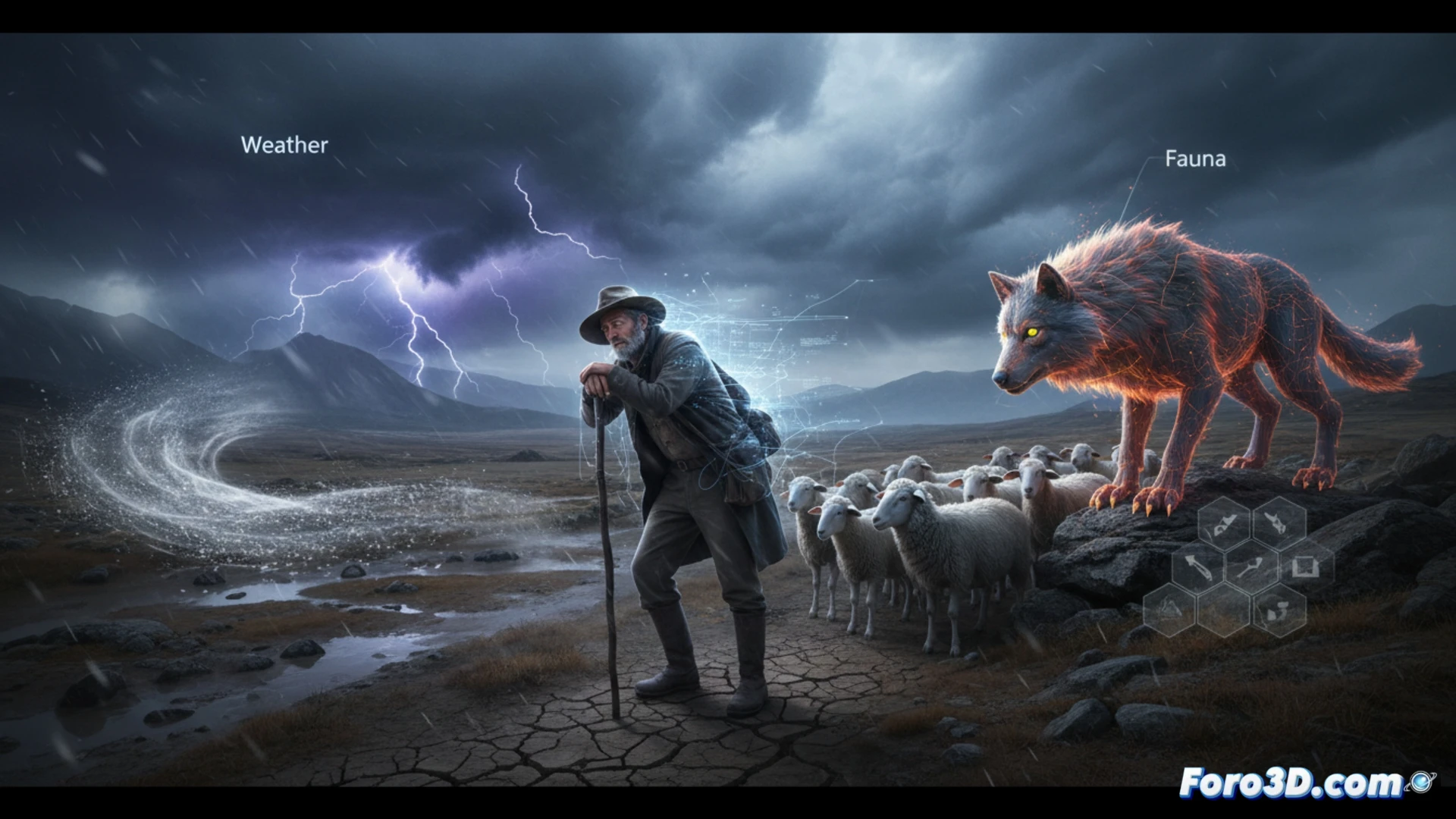
The technical key to representing these risks lies in capturing LIDAR terrain data. Using point clouds, we can digitally reconstruct steep slopes, loose rocks, and muddy surfaces where falls are frequent. The 3D animation incorporates a particle system to simulate rain or extreme heat, while advanced muscle rigging on the shepherd model allows for visualizing physical fatigue: an energy bar that decreases with each uphill step. Additionally, animal behavior models (wolves, dogs, and snakes) are integrated with proximity detection, triggering attack or bite animations in real-time, alerting to the risk of zoonoses such as tick bites.
Awareness Through the Digital Risk Map 🗺️
This interactive infographic not only documents but also educates. By visualizing the accumulation of kilometers traveled on a topographic heat map, the user understands the relationship between physical exertion and injuries. The representation of a predator attack or a snake bite ceases to be an abstract statistic and becomes an immersive experience. The ultimate goal is clear: transform rural accident data into a visual prevention tool, accessible to livestock associations and training centers.
How the interaction between the shepherd's accumulated fatigue and adverse weather patterns can be modeled in 3D to predict high-risk accident zones in extensive grazing terrains.
(PS: fluid physics for simulating the ocean is like the sea: unpredictable and you always run out of RAM)