The Norwegian company TGS has launched a new seismic acquisition project in the North Sea. The objective is to map the Åsta Graben area using a 3D streamer survey. The initiative aims to provide detailed subsurface images to support hydrocarbon exploration in a region of high geological interest.
Streamers and high-resolution data for the Norwegian subsurface 🌊
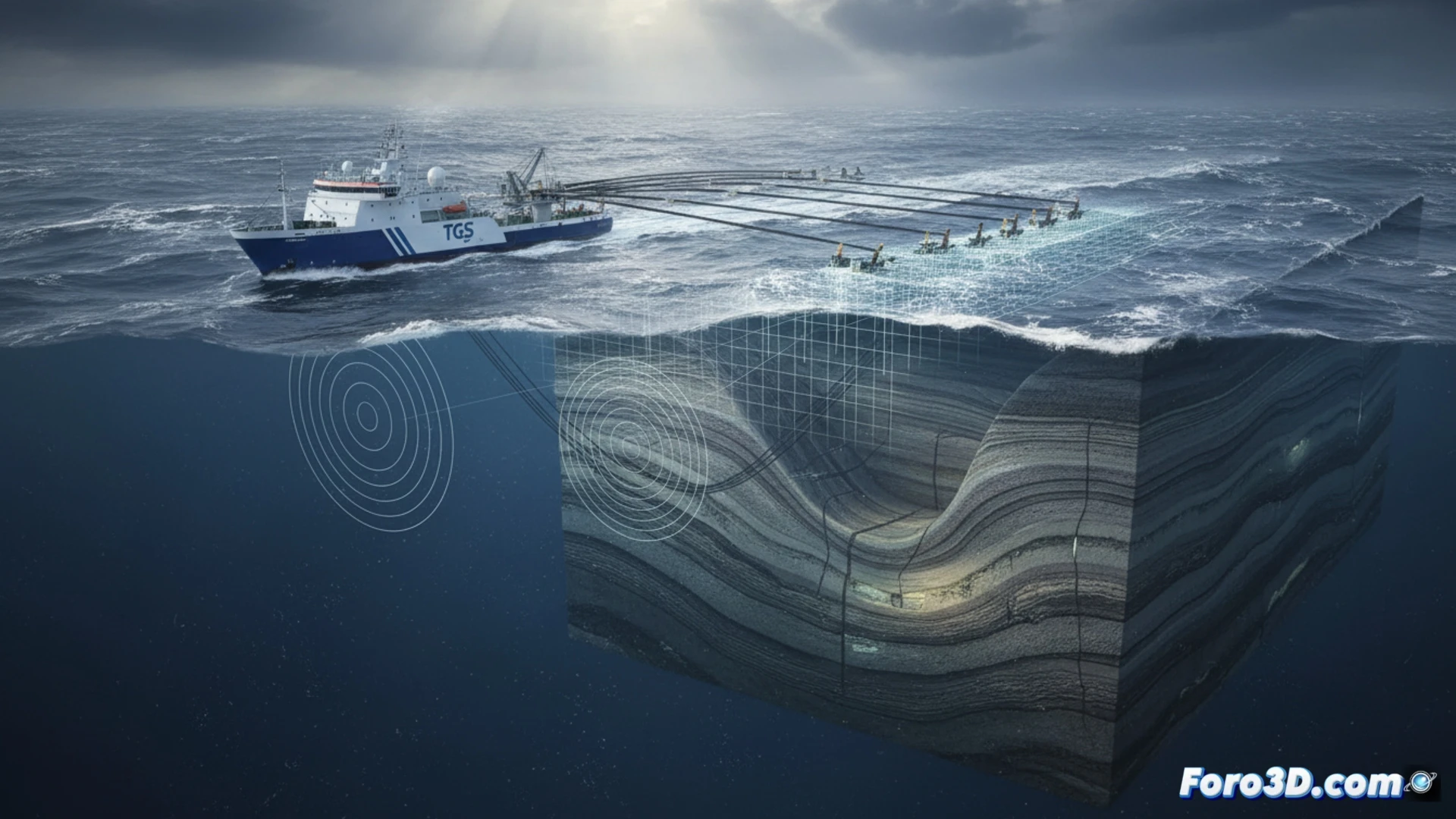
The survey will use a vessel equipped with state-of-the-art streamers to cover the Åsta Graben area. TGS will deploy multiple hydrophone cables that will record waves reflected by subsurface layers. The data obtained will allow operators to identify structural and stratigraphic traps. The campaign is part of the North Sea acquisition season, where weather conditions are a key factor for planning.
Searching for oil while Norway looks to renewables 🛢️
While the Norwegian government sells electric cars like hotcakes and funds wind farms, TGS sticks to its usual business: finding hydrocarbons beneath the seabed. Åsta Graben will receive a visit from a ship that will drag kilometers of cables to map the subsurface. Because, hey, just because Norway has a multi-million dollar sovereign wealth fund thanks to oil doesn't mean it's going to stop selling it. After all, windmills don't pay the pensions.