The evaluation of rock impact on vital infrastructure, such as bridges, tunnels, and dams, represents a critical challenge in disaster prevention engineering. Rockfalls, caused by natural phenomena or erosion, can generate catastrophic damage. Thanks to 3D technologies, it is now possible to model these events with millimeter precision, anticipating trajectories and forces to design effective protective barriers and predictive maintenance protocols.
Photogrammetry and digital twins for trajectory analysis 🛰️
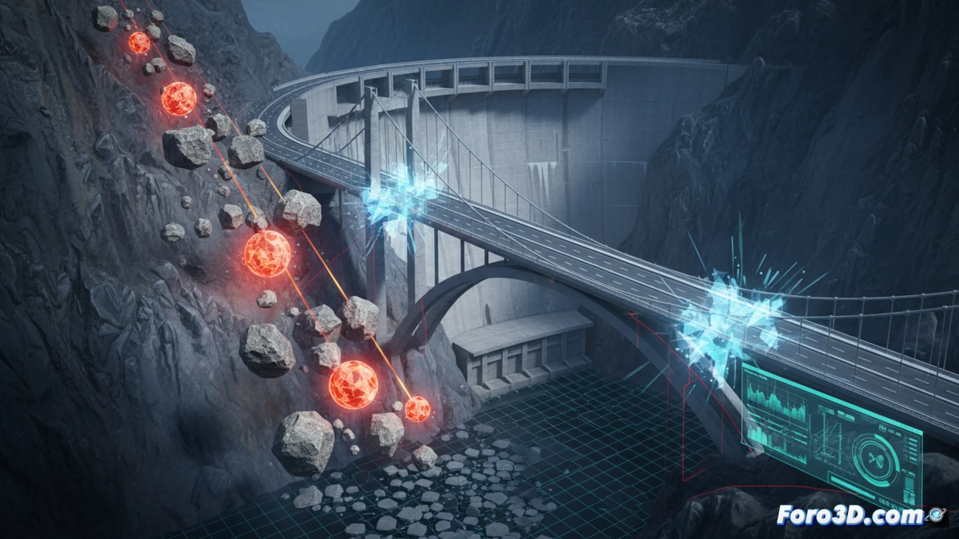
The process begins with terrain scanning using drones equipped with LiDAR sensors or high-resolution photogrammetry. This data generates a digital terrain model (DTM) that includes the exact geometry of slopes and structures. Subsequently, physics simulation engines, such as those based on the discrete element method (DEM), calculate rock trajectories, considering factors like slope, surface roughness, and block mass. The result is a digital twin where the impact is simulated, measuring the kinetic energy transferred to the infrastructure. This allows identifying weak points in bridges or dams without exposing human teams to real danger.
Active prevention through predictive models 🛡️
The true utility of these simulations lies not only in reaction but in anticipation. By integrating impact data with IoT sensors installed in the infrastructure, early warning systems are created. A real-time updated digital twin can predict the fatigue of a bridge pillar after multiple simulated impacts, scheduling repairs before collapse occurs. In a world where natural disasters are increasingly frequent, 3D simulation ceases to be a design tool and becomes an indispensable digital shield for public safety.
How can 3D simulation of rock impact predict failures in critical infrastructure such as bridges and dams without the need for costly full-scale destructive testing?
(PS: Simulating disasters is fun until the computer crashes and you are the disaster.)