The forestry engineer operates in a high-risk environment: steep terrain, remote areas, dangerous wildlife, and extreme weather conditions. However, the greatest threats are wildfires and massive pest infestations, catastrophic events that demand an immediate and precise response. 3D simulation technology has become a vital tool for anticipating these disasters and protecting the lives of the professionals who manage our forests.
Predictive modeling of wildfires and pests on complex terrain 🔥
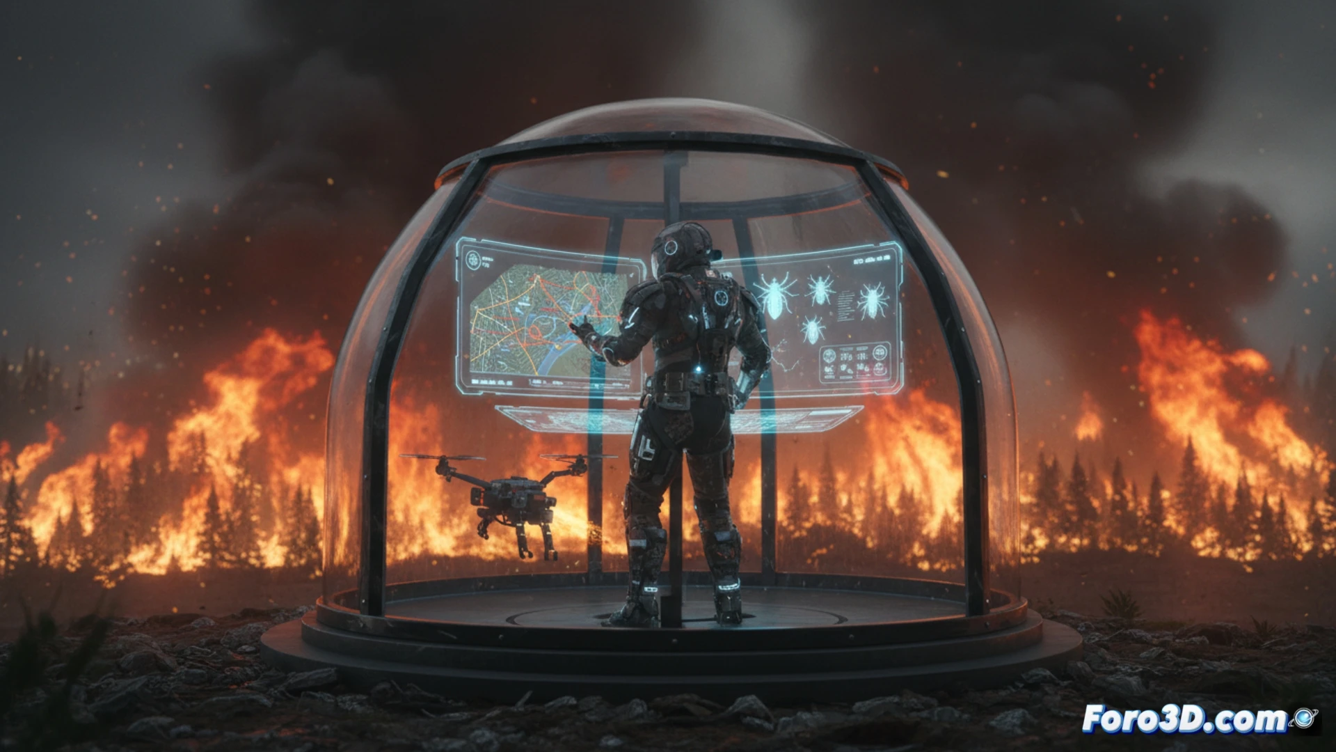
3D simulation allows recreating the topography of steep slopes and ravines to model fire spread under different wind and humidity conditions. These predictive models identify critical ignition points and areas of fuel accumulation, essential for planning evacuation routes and safe intervention points. For pests, 3D spatial analysis detects dispersion patterns of insects or pathogens, enabling forestry engineers to establish containment barriers before an outbreak becomes an ecological catastrophe. Real-world cases such as the management of the Pedrógão Grande fire in Portugal or the pinewood nematode plague in Spain demonstrate how these visualizations reduce reaction time and minimize personnel exposure to lethal zones.
Active prevention: the value of simulation in risk management 🛡️
Beyond emergency response, 3D simulation transforms prevention. Forestry engineers can virtually rehearse off-road maneuvers on high-slope paths or assess terrain stability before moving into hard-to-reach areas. This technology not only saves lives but also optimizes resources and reduces work-related stress by providing a clear map of hazards. In a profession where every outing can be a battle against nature, anticipation is the best defense.
As a forestry engineer, how can 3D simulations of catastrophes, such as fires or landslides, integrate remote sensor data to predict in real-time the evolution of danger on steep terrain and thus optimize evacuation routes?
(PS: Simulating catastrophes is fun until the computer crashes and you become the catastrophe.)