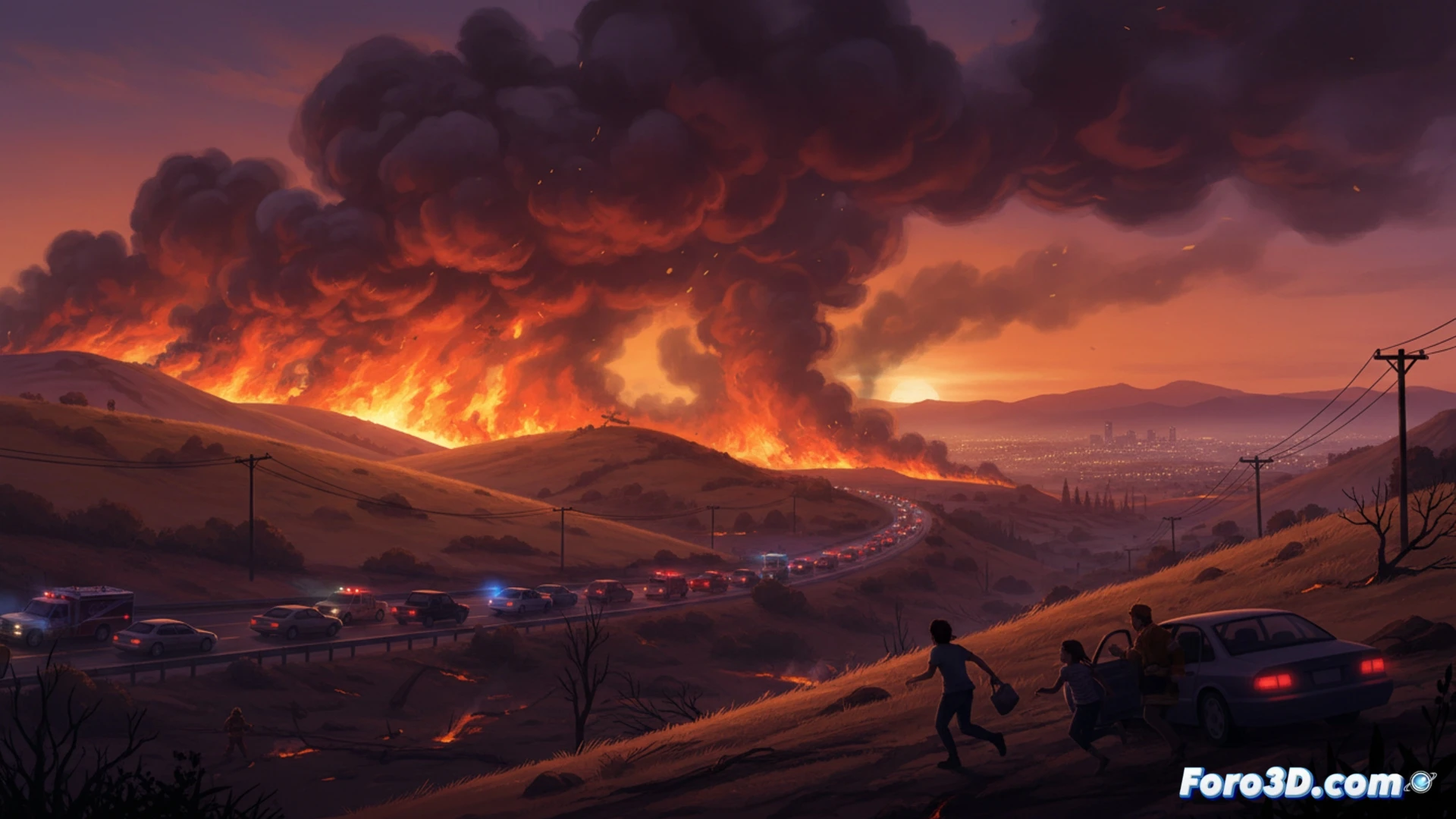
On Monday, a wildfire named Sandy Fire broke out in Simi Valley, a suburb of Los Angeles, forcing the evacuation of thousands of residents. The fire, which started late in the morning, spread rapidly due to wind gusts of up to 56 km/h, reaching 552 hectares by nightfall. Authorities issued evacuation orders for parts of Simi Valley and neighboring Thousand Oaks, while several neighborhoods in northern Los Angeles were placed under warnings.
Drones and Satellites: The Technology That Anticipates Fire Chaos 🛰️
In the fight against the Sandy Fire, technology plays a key role. Emergency teams use drones with thermal cameras to map the fire's advance in real time, while NASA satellites provide data on the intensity and direction of the flames. Early warning systems, such as mobile apps and smoke sensors, allow residents to receive instant notifications. However, wind speed remains an unpredictable factor that challenges predictive models.
The Wind: The Buddy Who Always Shows Up Uninvited 🌬️
The wind, that friend who never gives notice, decided to join the Sandy Fire party with gusts of 56 km/h, turning a simple fire into a spectacle of flying flames. As firefighters tried to control the disaster, the wind blew as if directing a choreography of evacuations. Residents, between packing suitcases and praying for their homes, could only wonder if the wind would also order a coffee to go.