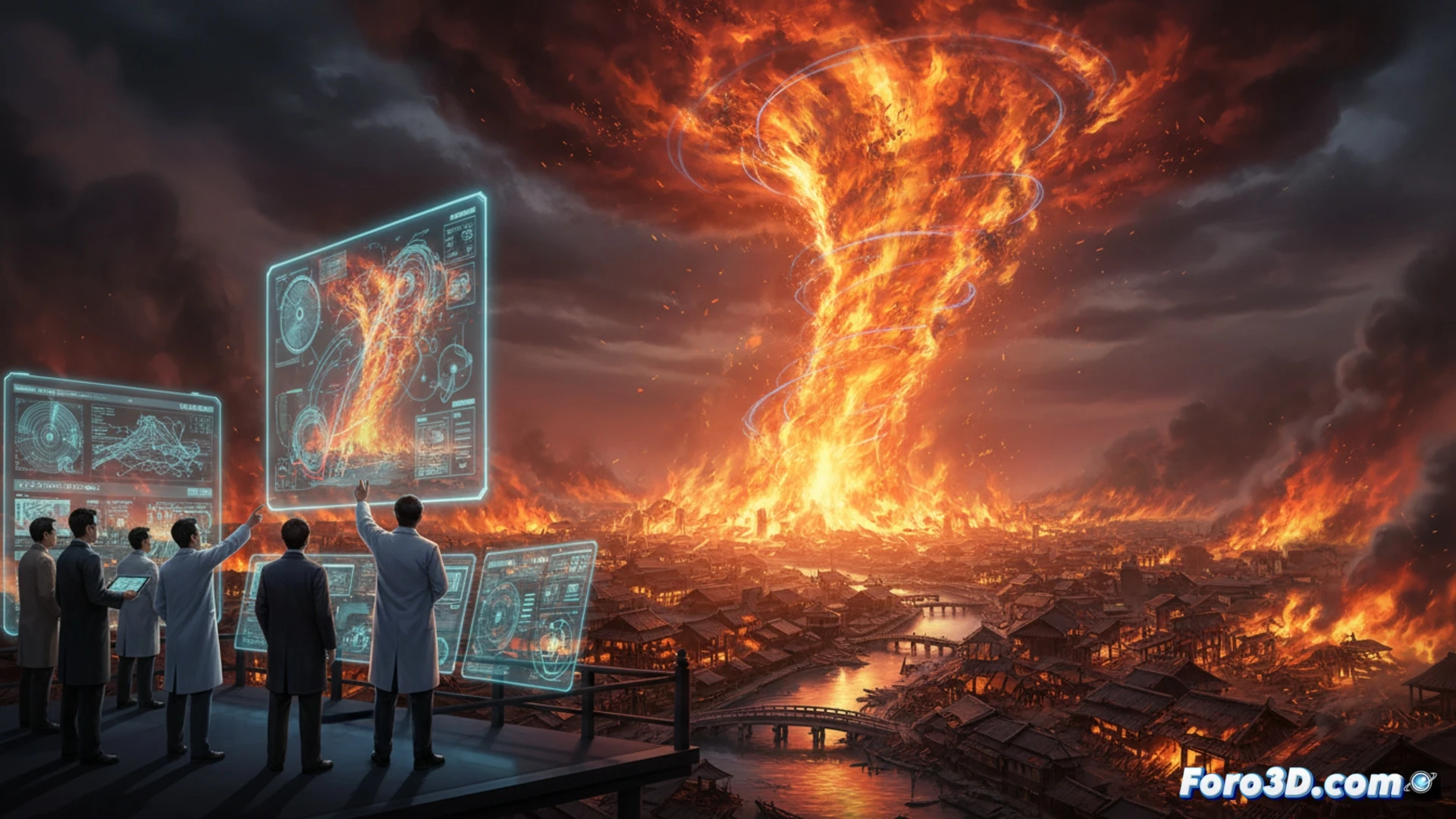
On September 1, 1923, the Great Kanto Earthquake triggered one of the deadliest urban catastrophes in history. However, the earthquake was not the sole culprit. The true horror arrived with the massive fires that swept through Tokyo, generating a terrifying phenomenon: the Fire Hurricane. This whirlwind, fueled by wooden structures and chaotic winds, razed everything in its path. Today, decades later, we can understand its mechanics thanks to simulation tools like Houdini and FDS.
Technical Pipeline: Pyro in Houdini and FDS for Fluid Dynamics 🔥
To digitally recreate this event, a hybrid pipeline was implemented. In Houdini, the Pyro solver was used to simulate the turbulent behavior of the fire. Key parameters included a high vortex dissipation rate to emulate the wind generated by the fire itself, and a base ignition temperature of 600 degrees Celsius to mimic wood combustion. In parallel, Fire Dynamics Simulator (FDS) was employed to model fire spread on an urban scale. FDS solved the Navier-Stokes equations to predict how heat and smoke interacted with the buildings of the era. Finally, density and temperature data were exported from FDS to Maya to refine the lighting and visual integration of the flames.
Lessons from the Past: Prevention of Urban Catastrophes 🏙️
These simulations are not just a technical exercise, but a vital tool for prevention. By recreating the Tokyo Fire Hurricane, engineers can analyze how urban layout and construction materials influence the spread of massive fires. It was observed that fire whirlwinds form when heat generates an unstable convection column, sucking in cold air from the sides. Understanding this pattern allows for designing more effective firebreaks and evacuation systems that minimize risk in modern megacities. 3D technology turns history into a laboratory for saving lives.
Would you export the results to GIS format?