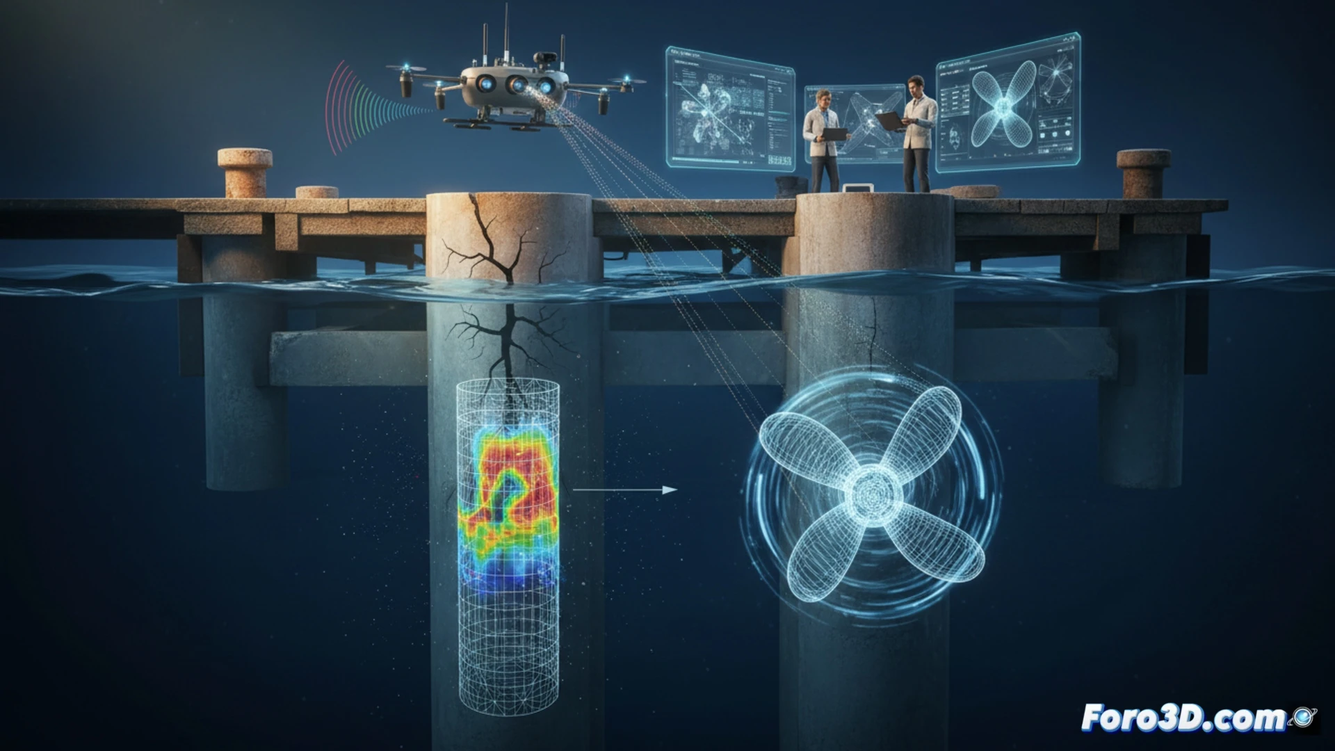
When a large-tonnage propeller impacts port infrastructure, the structural consequences can be devastating. In a recent forensic case, a team of engineers combined side-scan sonar technology with aerial photogrammetry to document a cracked dock. The goal was not only to record the damage but to calculate the exact power of the responsible propeller using a precise 3D model and impact simulations. ⚓
Technical workflow: From point cloud to CFD simulation 🛠️
Data acquisition began with a multibeam sonar processed in SonarWiz, generating high-resolution bathymetry of the seabed and hull geometry. Simultaneously, a drone captured images of the damaged dock, processed in Agisoft Metashape to create a dense point cloud and a textured orthomosaic. Both datasets were merged in Blender, where the propeller and pile were modeled with millimeter precision. The volumetric model was exported to Orca3D, where a computational fluid dynamics (CFD) simulation was run to recreate the impact conditions, correlating the observed cracks with the hydrodynamic force and generated torque.
The value of digital reconstruction in accident investigation 🔍
This case demonstrates that 3D documentation not only serves to visualize damage but as an expert calculation tool. By integrating sonar, photogrammetry, and simulation software, it is possible to determine not only liability but the exact mechanics of the incident. For scene analysts, this forensic workflow opens a new avenue for quantifying impacts on port infrastructure, where physical evidence is ephemeral and model precision is the key to the technical opinion.
How can the fracture sequence and impact energy in a dock crack caused by a propeller be determined using photogrammetry and finite element simulation techniques?
(PS: In scene analysis, every scale witness is a small anonymous hero.)