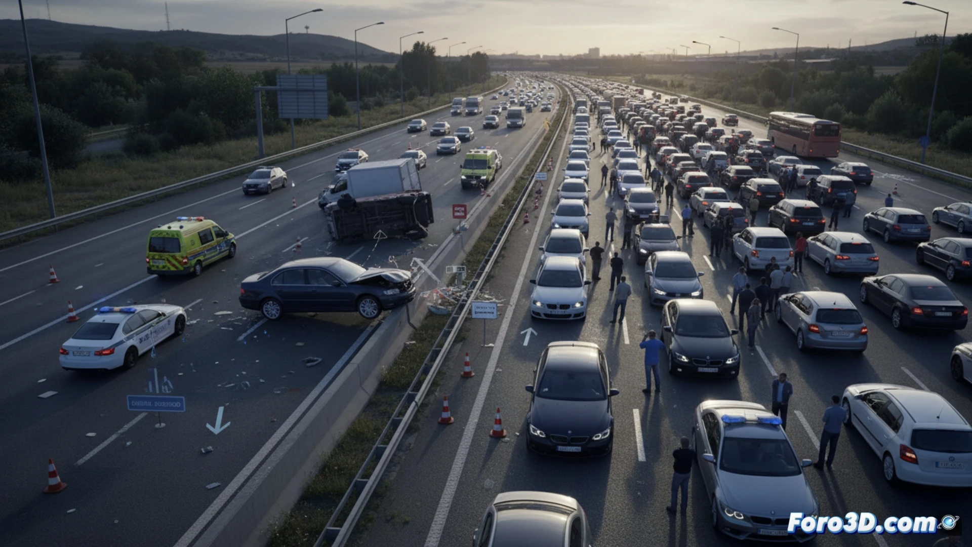
Last April 30, an accident on the A-2 near Alcalá de Henares forced the closure of the left lane for hours, generating up to 3 kilometers of traffic jams at the exit of Madrid. For specialists in scene analysis, this type of incident represents a perfect case study where digital documentation and simulation allow breaking down the factors that transformed an impact into a major traffic collapse.
Photogrammetry and LiDAR for scene capture 🚁
The reconstruction of the accident begins with precise capture of the environment. In this section of the A-2, the technical team would deploy LiDAR sensors to obtain a high-density point cloud, recording the final position of the vehicles and the geometry of the roadway. Simultaneously, a drone flight would be carried out to apply photogrammetry, generating a textured 3D model of the 3 km affected area. With this data, the scene is integrated into a game engine such as Unreal Engine, allowing visualization from any angle of the exact position of the cars, the damage to the barrier, and the lane reduction, facilitating the calculation of trajectories and speeds through inverse physical simulation.
Contributing factors and lessons for road safety 🛡️
When analyzing the digitized scene, variables such as the condition of the asphalt, visibility at that time, and available braking distance can be cross-referenced. The simulation reveals how the closure of a single lane during rush hour causes a domino effect that leads to the observed traffic jams. This approach not only serves to clarify responsibilities but also allows traffic engineers to propose improvements in dynamic signage and incident management, reducing the risk of secondary collisions in future accidents on the A-2.
What specific advantages does 3D reconstruction offer over traditional analysis methods for determining the exact dynamics of the impact and the sequence of the lane closure in an accident like the one that occurred on the A-2?
(PS: In scene analysis, every scale witness is a little anonymous hero.)