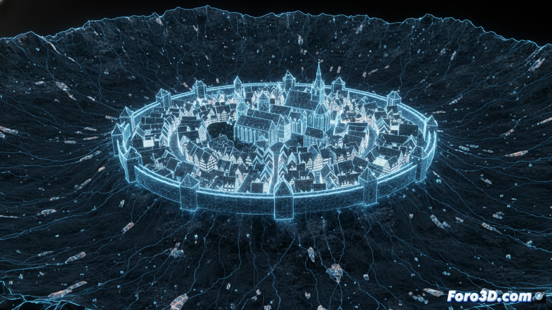
The German city of Nördlingen presents a unique case for digital archaeology: a medieval town whose 2.7-kilometer walls trace the exact outline of a 15-million-year-old meteorite crater. Until the 1960s, the depression was believed to be an extinct volcano, but the impact of a one-kilometer asteroid created a 24-kilometer-wide hollow. Today, photogrammetry and laser scanning techniques allow us to document how 14th-century architecture perfectly overlays the Miocene geology. 🌍
Photogrammetry of the wall and impact modeling 🏰
The wall, ordered built in 1327 by Louis the Bavarian, is one of three German medieval fortifications preserved almost intact and the only one fully walkable. For digital archaeology, it is a perfect study object: its stones contain approximately 72,000 tons of microdiamonds, formed by the pressure of the impact at 70,000 km/h. Using high-resolution orthophotos and LiDAR point clouds, a 3D model can be generated that links the circular shape of the historic center, visible from the Daniel tower, with the structure of the primary crater one kilometer in diameter. This digital twin allows analysis of how the city leveraged the impact topography for its defense.
Geological and cultural layers in a single model 🔬
The virtual reconstruction of Nördlingen not only preserves architectural heritage but also reveals an overlay of histories. The 3D scanning of the walls shows how medieval builders used suevite, a rock formed by the asteroid impact, rich in microscopic diamonds. By integrating geological data from the Ries crater with urban planimetry, digital archaeology explains why the city has an almost perfectly circular layout. Thus, the 3D model becomes a time machine connecting the Miocene with the Middle Ages.
The 3D scanning of Nördlingen has revealed that its 2.7-kilometer walls are built with suevite, a rock rich in microscopic diamonds formed by the meteorite impact that created the crater, how can this digital technology help identify other unusual building materials in archaeological sites with extraordinary geological origins?
(PS: If you dig at a site and find a USB, don't plug it in: it could be Roman malware.)