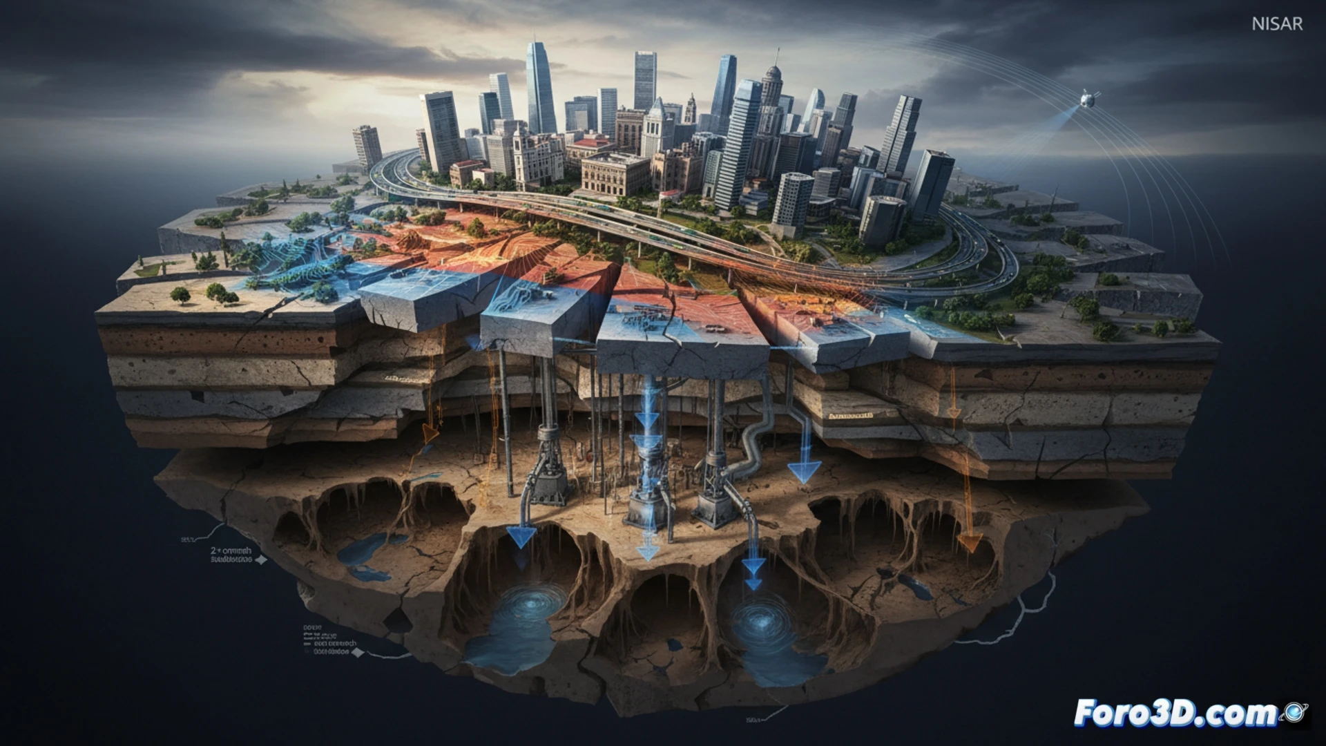
NASA and ISRO have deployed the NISAR satellite to map with millimeter precision the subsidence affecting Mexico City. This phenomenon, caused by massive groundwater extraction, compacts sediments and sinks the surface at an alarming rate. The new data, captured between October 2025 and January 2026, shows areas sinking more than two centimeters per month, a slow but continuous catastrophic process threatening 20 million people.
Synthetic aperture radar for monitoring ground deformation 🛰️
The synthetic aperture radar (SAR) aboard NISAR enables near real-time 3D mapping of ground deformation. By comparing radar images taken on different dates, scientists detect vertical and horizontal ground displacements with centimeter precision. This technology visualizes subsidence as a differential process: while some areas sink at 40 cm per year, others remain stable. These differences generate critical structural stresses in buildings, pipelines, and drainage systems, already causing material damages worth 3.312 billion euros annually.
3D simulations for urban disaster prevention 🏙️
Satellite monitoring becomes a crucial tool for early warning. 3D simulations based on NISAR data allow modeling how subsidence alters the seismic response of the soil, increases flood risk, and mobilizes salts and contaminants in aquifers. For urban planners, these deformation maps are essential for identifying critical zones, reinforcing infrastructure, and preventing a major structural collapse. The technology no longer just documents the disaster but offers a roadmap to mitigate it.
How could NISAR's 3D mapping anticipate the collapse of critical infrastructure in Mexico City before a major catastrophe occurs?
(PS: Simulating catastrophes is fun until the computer crashes and you are the catastrophe.)