Mount Mayon in the Philippines has erupted with a level 3 alert issued by Phivolcs. Authorities have established a 6-kilometer danger zone around the crater, forcing the evacuation of dozens of villages. Lava flows are already extending several kilometers downslope, requiring advanced simulation tools to predict their advance and plan for population safety.
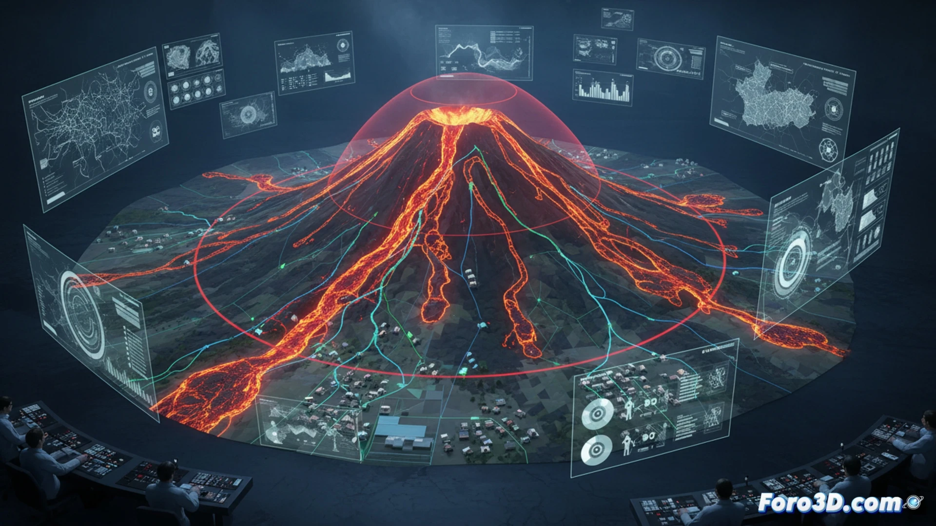
Digital twins and pyroclastic flow simulation 🌋
Digital twin technology allows recreating Mayon's perfect cone in a 3D environment. Using LIDAR data and digital elevation models, volcanologists can simulate the trajectory of basaltic lava flows and lahars. These simulations consider terrain slope, magma viscosity, and natural barriers. The result is a dynamic hazard map that updates the 6 km exclusion zone in real time, showing exactly which villages will be affected in the coming hours, thus optimizing evacuation routes.
Risk visualization as a communication tool 🛡️
Beyond technical prediction, 3D modeling of Mayon serves as a visual bridge between scientists and citizens. By rendering the extent of the lava and the safety perimeter, authorities can show evacuees why their homes are at risk without relying on abstract maps. This immersive representation of the disaster reduces misinformation and accelerates compliance with evacuation orders, saving lives before the volcano reaches a critical alert level.
How can 3D modeling of Mount Mayon's lava flows be integrated with real-time data from Phivolcs to optimize evacuation routes and minimize human risk during a level 3 eruption?
(PS: Simulating disasters is fun until your computer melts down and you are the disaster.)