Walking is a daily activity we consider safe, but statistical reality shows that pedestrians are exposed to significant risks in the city. Without the protection of a vehicle, any miscalculation, distraction, or deficient infrastructure can lead to a serious accident. The urban environment, with its complex network of traffic and shared spaces, becomes the main risk factor for those traveling on foot, a fact that demands in-depth analysis and advanced simulation tools.
Digital Twins and Simulation of Urban Accident Rates 🚦
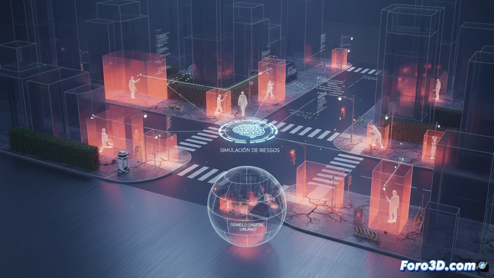
3D modeling technology allows us to build digital twins of intersections and avenues to recreate pedestrian risk scenarios with high fidelity. We can simulate a vehicle's trajectory at a hazardous crossing, calculate visual blind spots for the driver, or model the impact of a fall on deteriorated pavement. By integrating historical accident data, these models identify black spots where the probability of a hit-and-run or incident is highest. This visualization not only helps understand the dynamics of an accident but also allows for virtually testing improvements such as relocating crosswalks or installing countdown traffic lights.
Towards a Safer City from Virtual Design 🏙️
Preventing urban catastrophes begins with identifying the latent danger on every corner. By using 3D simulations, we transform abstract statistics into a visual experience that reveals pedestrian vulnerability. This approach is not only a tool for urban planners but also a call to rethink the city from the perspective of the most vulnerable. If we can anticipate risk in a virtual environment, we are one step closer to designing streets where walking is not only safe but truly innocent.
How can 3D modeling help identify and visualize the blind spots or most dangerous conflict zones for pedestrians at complex urban intersections?
(PS: Simulating catastrophes is fun until your computer crashes and you are the catastrophe.)