The rise of photovoltaic solar energy in war-torn territories presents a critical technical dilemma. Installers, often local personnel without specialized training, face lethal electrical risks from direct current, falls from unstable roofs, and the handling of heavy panels in environments where safety infrastructure has been destroyed. 3D reconstruction of these scenarios allows for the identification of blind spots of danger before any intervention begins.
Virtual reconstruction of roofs and electrical wiring ⚡
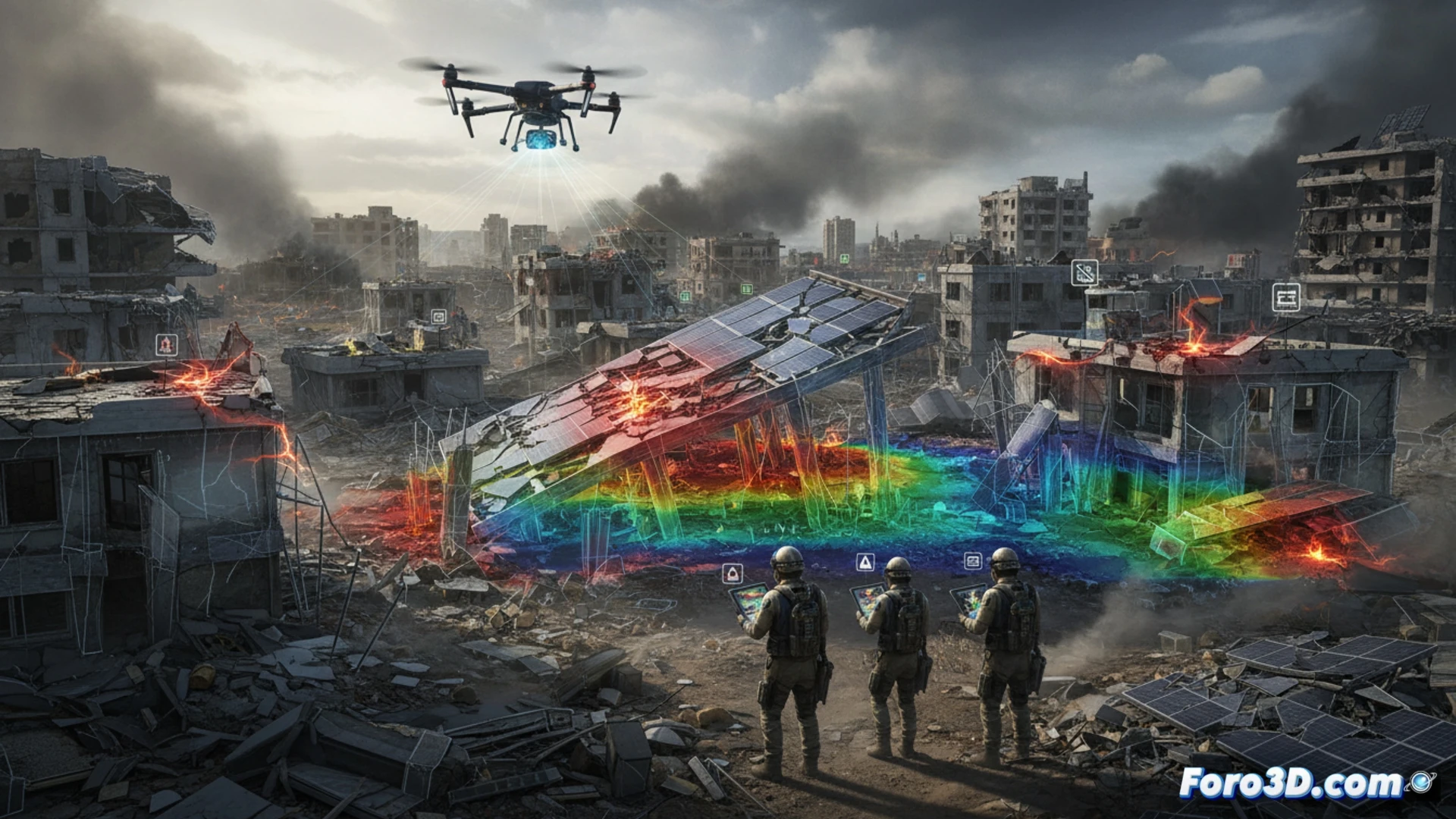
Three-dimensional modeling of roofs damaged by bombings, combined with the simulation of high-voltage wiring routes, offers an unprecedented prevention tool. Through LiDAR scanning and photogrammetry, digital twins can be generated that reveal the exact location of exposed conductors, the actual slope of a collapsed roof, or the optimal orientation to avoid shadows that cause overheating. This prior analysis significantly reduces the risk of electrocution from arc flash and falls into the void, allowing for the planning of safety anchors and remote disconnection points in a safe virtual environment.
The double vulnerability of the technician in war 🛡️
Beyond the obvious physical risks, the solar technician in a conflict zone operates under extreme psychological pressure and with limited resources. Prolonged exposure to UV radiation without adequate protection adds to the stress of working on structures that may be secondary targets. Visualizing these scenarios in 3D not only saves lives but also humanizes the technical data, showing that each installed panel is an act of resistance that requires maximum protection for those who rebuild light in the midst of darkness.
How can 3D mapping of solar risks predict the structural vulnerability of photovoltaic panels to shrapnel impacts in active conflict zones.
(PS: 3D war maps are like renders: the more realistic they are, the more time you need to process them)