The detection of clandestine graves has evolved thanks to the combination of LiDAR and ground-penetrating radar (GPR), enabling three-dimensional modeling of the subsurface. This technical synergy, applied in forensic archaeology, reveals anomalies in soil compaction that go unnoticed by the naked eye. Analysis of sedimentation patterns, using specialized software, provides precise estimates of the time elapsed since the original excavation.
Technical workflow: sensor and software integration 🛠️
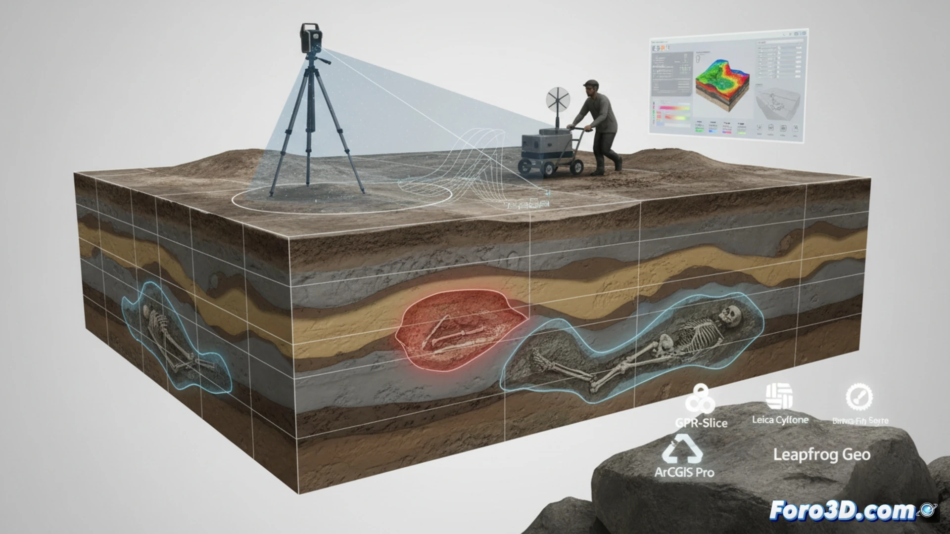
The process begins with a terrestrial LiDAR survey (Leica Cyclone) to capture surface topography with millimeter precision. Subsequently, ground-penetrating radar (GPR-Slice) generates cross-sections of the subsurface, detecting changes in soil density. ArcGIS Pro merges both point clouds and GPR profiles into a unified 3D model. Leapfrog Geo interprets sedimentary discontinuities, modeling volumes of removed soil and calculating differential compaction rates. This methodology allows distinguishing a recent grave from an old one, based on the consolidation speed of the altered terrain.
Forensic implications and modeling challenges ⚖️
Estimating excavation time is crucial in human rights investigations. Sedimentation patterns, analyzed with Leapfrog Geo, reveal fill layers and progressive settlement. However, accuracy depends on factors such as soil type and moisture. This approach not only locates graves but also provides key temporal evidence for legal proceedings, demonstrating how modern geomatics transcends conventional topography to serve social justice.
What advantages does integrating LiDAR and ground-penetrating radar data in 3D subsurface modeling offer for detecting clandestine graves compared to using each technique separately?
(PS: 3D topography is like making a treasure map, but the treasure is an accurate model.)