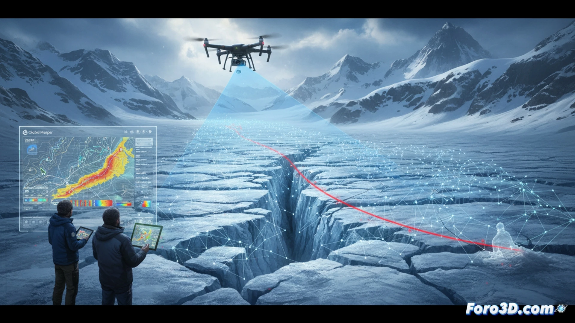
The tragedy on an Alpine glacier, where a mountaineer lost their life after a slip, has prompted an unprecedented technical analysis. The combined use of aerial LiDAR and digital photogrammetry has allowed rescue teams and experts to reconstruct the ice topography with millimeter precision, revealing friction marks and the determining factors in the fall. This article breaks down the geospatial workflow used for the accident simulation.
Geospatial workflow: from the point cloud to the friction model 🗺️
The process began with data capture using an aerial LiDAR flight and a drone equipped with a high-resolution camera. The point clouds were processed in Pix4Dmapper to generate a dense surface model and an orthomosaic of the glacier. Subsequently, the digital terrain model (DTM) was imported into Global Mapper, where slope and curvature analysis tools were applied to identify slip lines. Using GeoPandas in Python, the fall trajectories were segmented and the dynamic friction coefficients of the ice were calculated, correlating surface roughness with the estimated accident speed.
Geotechnology as a silent witness in the mountains ⛰️
Beyond topography, this case demonstrates how geomatics becomes a crucial forensic tool in extreme environments. The ability to simulate ice friction and recreate the fall dynamics allows researchers to establish precise causes, improving safety protocols in mountaineering. The integration of LiDAR and photogrammetry data not only documents the accident but also offers a technical lesson on the fragility of glacial terrain and the importance of 3D modeling in preventing future tragedies.
How can the combination of LiDAR data and high-resolution photogrammetry overcome the limitations of unstable glacial terrain to accurately model the trajectory of the fatal slip and the kinematic forces involved in the accident?
(PS: 3D topography is like making a treasure map, but the treasure is an accurate model.)