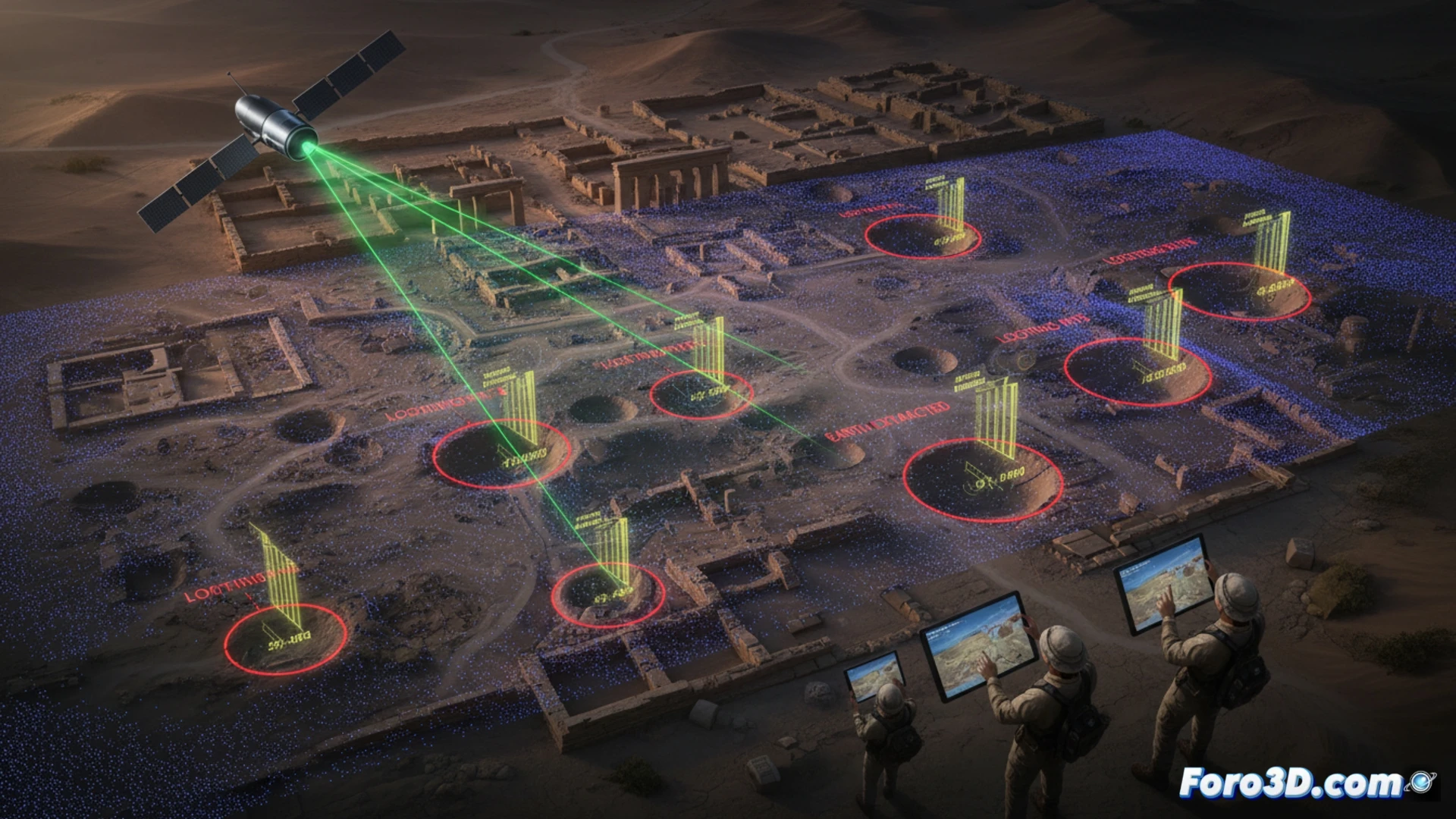
The looting of archaeological sites in conflict zones has reached critical levels, fueling the black market for artifacts. However, a new methodology based on comparing historical and current satellite LIDAR point clouds allows for the detection of looting pits with millimeter precision. This workflow, integrating Leica Cyclone, CloudCompare, and ArcGIS Pro, not only quantifies the volume of extracted earth but also estimates the number of stolen objects to facilitate their tracking.
Technical workflow: from point cloud to volumetric calculation 🛰️
The process begins with the acquisition of satellite LIDAR data from two time periods: one prior to the conflict and one recent. In Leica Cyclone, both point clouds are cleaned and registered to ensure georeferenced alignment. Subsequently, in CloudCompare, a cloud-to-cloud difference algorithm (M3C2) is applied to identify areas where the surface has dropped, revealing the edges of looting pits. With this data, the affected areas are exported to ArcGIS Pro, where a cut-and-fill analysis is performed to calculate the exact volume of removed sediment. This value, divided by the estimated average size of an artifact in the site's context, allows for inferring the number of pieces stolen.
Digital preservation in the era of destruction 🏛️
The ability to measure damage remotely transforms digital archaeology into a tool for cultural justice. By quantifying looting with objective data, evidence can be presented in international courts against traffickers, and rescue zones can be prioritized. This approach demonstrates that 3D technology not only reconstructs the past but also protects the heritage that still stands, even under crossfire.
How can satellite LIDAR combined with automated detection algorithms identify illegal excavations in real time at archaeological sites located in conflict zones without safe ground access.
(PS: If you dig at a site and find a USB drive, don't plug it in: it could be malware from the Romans.)