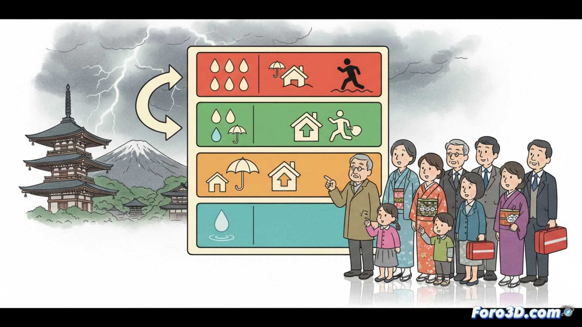
Starting May 28, the Japan Meteorological Agency reorganizes disaster prevention information into five alert levels, directly linked to evacuation calls. The system aims to translate complex data on heavy rainfall into concrete actions for residents, eliminating common confusion about when and how to protect themselves during a natural disaster.
How the new technical danger scale works 🌧️
The system classifies the threat from level 1 to 5, where 1 indicates early attention and 5 requires immediate evacuation in the face of imminent danger. Each level is associated with specific alerts, such as landslides or floods, and recommended actions. The underlying technology integrates data from weather radars and predictive models, but the real change lies in simplification: a color and number code that anyone can interpret without relying on satellite maps. The goal is to reduce reaction time, not to impress with graphics.
Level 5: when GPS is useless for escape 📱
Because yes, now you'll know you're at danger level 5, but your phone will still run out of battery just when you need Google Maps to escape the deluge. Japanese logic is impeccable: they warn you with five levels, but evacuation remains a high-risk sport where the main obstacle is finding your car keys under 30 centimeters of water. Sure, at least you won't have to debate whether the heavy rain warning was for today or next Monday.