The State Meteorological Agency warns of the arrival of a cold and isolated Atlantic storm in Andalusia during the upcoming weekend. This phenomenon, characterized by low pressure and winter temperatures, threatens torrential rainfall in provinces such as Huelva, Seville, and Cadiz. The uncertainty in its trajectory, as it detaches from the jet stream, turns this threat into a perfect case study for simulating natural disasters using 3D technologies.
Terrain modeling and real-time flood simulation 🌊
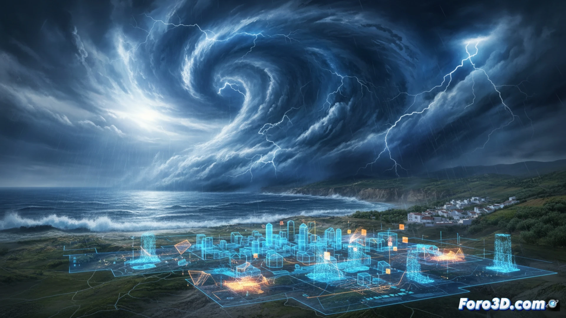
Given the unpredictability of this Atlantic storm, digital twins of Andalusian river basins become critical tools. Using high-resolution digital elevation models (DEMs), it is possible to simulate water flow over the terrain, identifying accumulation zones and critical overflow points. The use of real-time meteorological data, integrated into 3D rendering engines, allows emergency services to visualize the progression of rainfall and predict wave action on the Atlantic coast. This technology, applied to prevention, helps plan evacuations and manage the risk of flash floods on roads and in vulnerable urban areas.
Drought and the dilemma of 3D prevention 🌧️
Paradoxically, while farmers await these rains to alleviate the drought, the threat of floods and winds forces the activation of emergency protocols. 3D simulations not only predict the disaster but also allow for assessing the impact of moisture on dry terrain, which is prone to landslides. The combination of cold and water, atypical for this time of year, requires a detailed visual analysis of critical infrastructure. At Foro3D, we believe that visualizing these scenarios is the first step in transforming a natural catastrophe into a manageable event.
How can digital twins improve the prediction and mitigation of the effects of Atlantic storms in regions like Andalusia, and what technological limitations do they currently face in simulating extreme weather phenomena?
(PS: Simulating catastrophes is fun until your computer melts down and you become the catastrophe.)