The work of a forest ranger involves patrolling isolated areas with extreme weather risks, falls on uneven terrain, and the constant threat of wildfires. Added to this are attacks from poachers and bites from wildlife. 3D simulation of emergency scenarios makes it possible to anticipate these dangers, offering prevention tools that save lives in hostile environments.
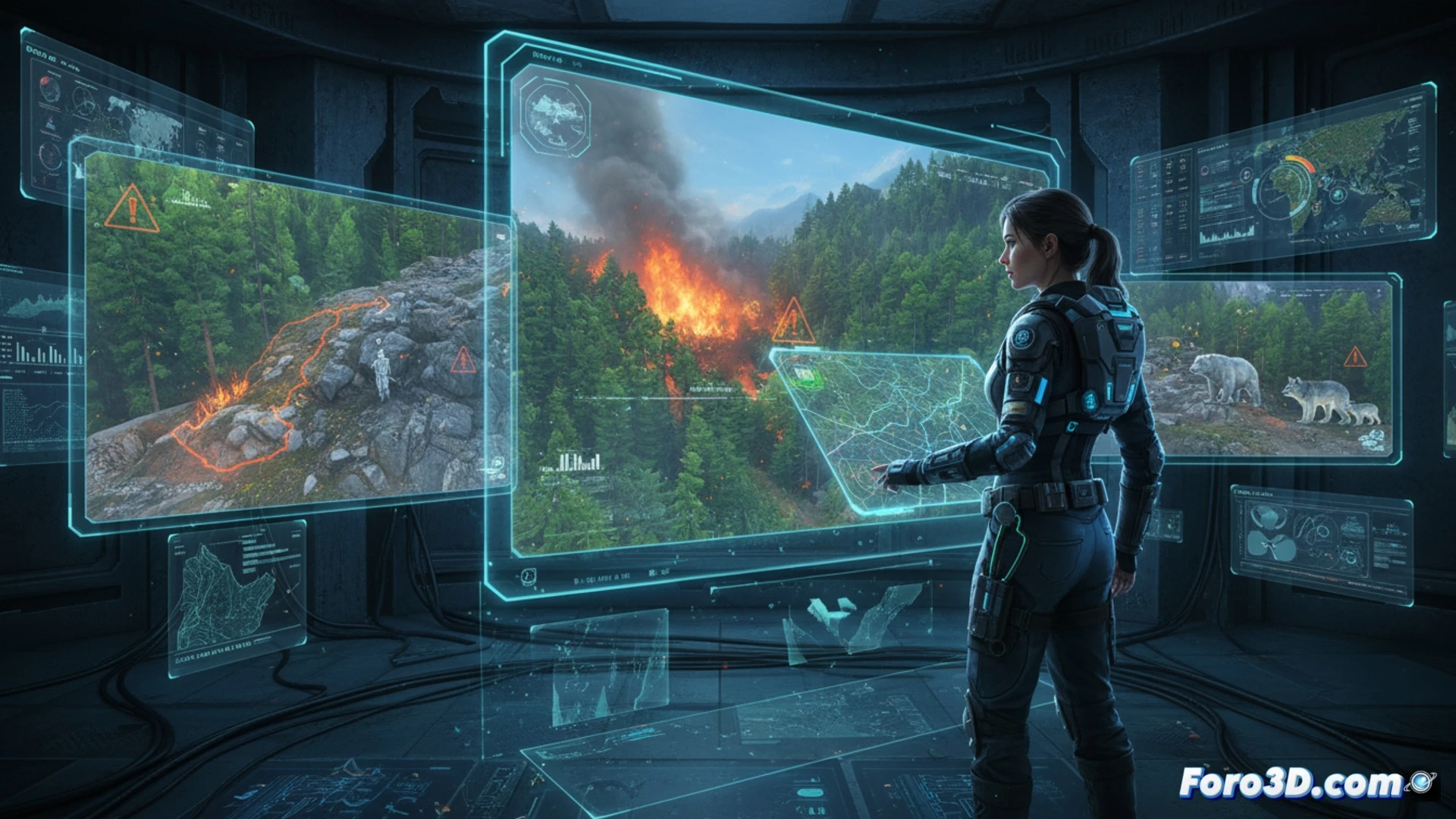
Propagation simulation and terrain digital twins 🌲
3D terrain modeling, combined with real-time meteorological data, allows for the creation of digital twins of forest areas. These models simulate fire propagation, showing how wind and slope affect the fire. A forest ranger can visualize safe evacuation routes and shelter points before patrolling. Furthermore, simulating landslides or falling branches helps design safer trails, reducing accidents from falls and exposure to disease vectors like ticks.
Threat visualization and proactive response 🔥
Integrating IoT sensor data with 3D models allows for real-time alerts about the presence of poachers or aggressive animals. Climate risk analysis, such as electrical storms or hurricane-force winds, is visualized on three-dimensional maps to reschedule patrols. This technology transforms passive prevention into an active tool, where the forest ranger not only reacts but anticipates every danger with digital precision.
How can a forest digital twin anticipate extreme weather risks in real-time to alert the forest ranger before a catastrophe occurs?
(PS: Simulating catastrophes is fun until the computer crashes and you are the catastrophe.)