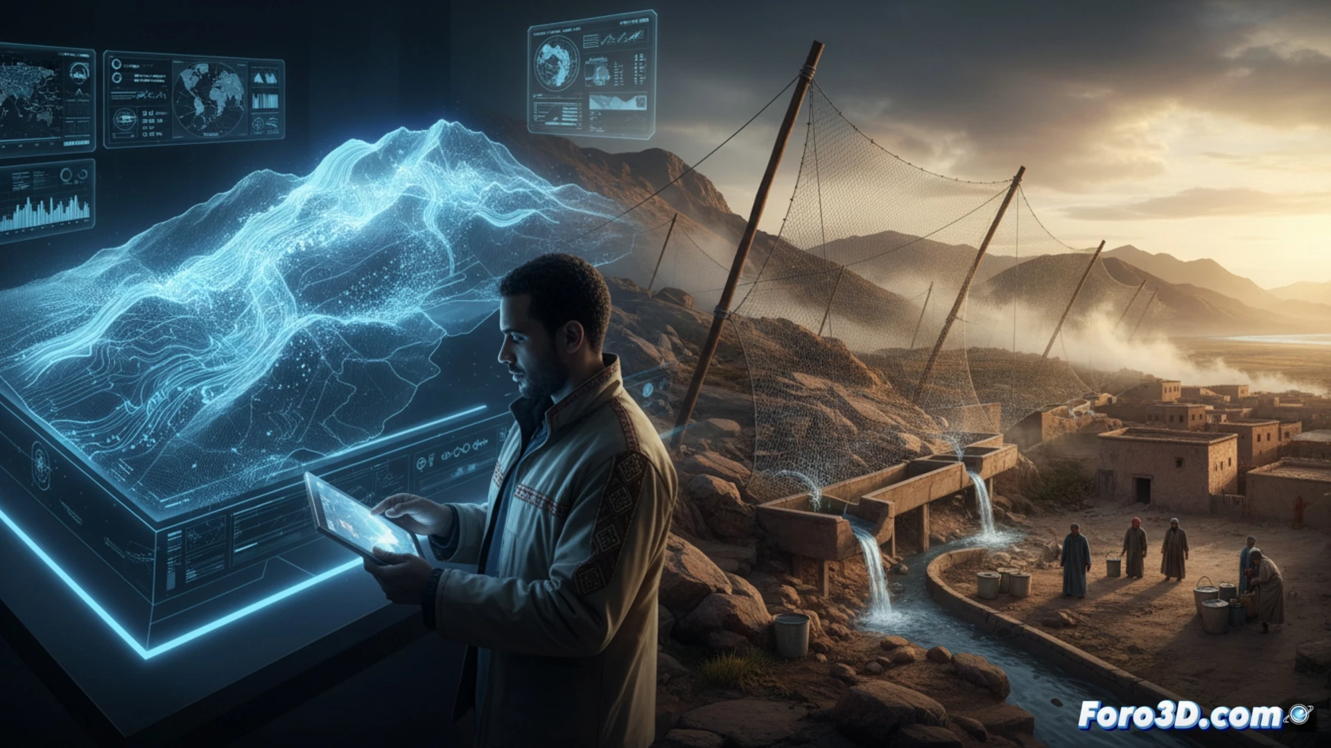
In southwestern Morocco, where the desert advances and wells dry up, communities in the Aït Baâmrane region have adopted an innovative solution: capturing fog from the mountains to obtain drinking water. Inspired by a fortuitous experiment in the Atacama Desert in the 1980s, the project uses enormous polymer nets installed on Mount Boutmezguida, at an altitude of over 1,200 meters, which trap Atlantic moisture and channel it by gravity to homes.
3D Modeling and Fluid Dynamics Simulation of Passive Fog Collection 🌫️
For a technical writer at Foro3D, this case is a perfect reverse engineering laboratory. We can create a digital twin of Mount Boutmezguida using LIDAR data and digital elevation models. The key lies in CFD (Computational Fluid Dynamics) simulation to analyze the fog flow through the polymer meshes. 3D software allows parameterizing critical variables: net inclination angle, fabric density, and prevailing wind speed. By rendering these virtual water particles, we can predict collection efficiency without costly physical prototypes. This approach allows scaling the solution to other arid regions where the desert advances, optimizing the placement of structures to maximize water yield.
From Climate Catastrophe to Social Engineering 🌍
3D technology models not only water droplets but also human impact. Previously, women spent up to four hours daily hauling 25-kilogram barrels, keeping girls out of school. By simulating the gravity-fed pipe network in a virtual environment, we visualize how time and labor are redistributed. The digital twin reveals that the real challenge was not technical, but cultural: the initial resistance to drinking fog water was overcome by demonstrating its purity through virtual quality analyses. In a world where drought is an announced catastrophe, 3D modeling is the first line of defense to ensure water flows where the desert prevails.
What variables would you consider to model this disaster? 💧