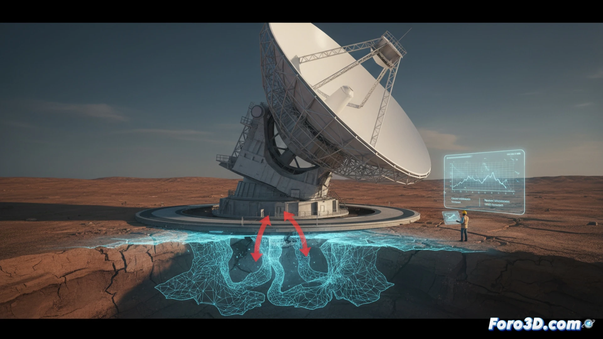
A 100-meter diameter radio telescope began losing precision in its tracking of celestial objects. Engineers, suspecting a structural deformation, performed a massive 3D scan of the rails and support base. The point cloud analysis revealed that the cause was not a mechanical defect, but differential ground settlement caused by groundwater extraction in the vicinity.
Structural diagnosis with Global Mapper, Leica Infinity, and ANSYS 🛠️
The process began with data capture using a high-density LiDAR scanner, generating a point cloud of millions of coordinates. With Leica Infinity, the data was georeferenced, and millimeter deviations in the flatness of the rails were detected. Global Mapper was used to create a digital terrain model and visualize the subsidence pattern. Finally, the deformed geometry was exported to ANSYS Mechanical, where the impact of dynamic loads on the structure was simulated. The virtual model allowed quantifying the deviation of the pointing axis and predicting its evolution over time.
Lessons from an invisible failure 🔍
This case demonstrates that a digital twin is not only useful for design but also for diagnosing hidden failures in critical infrastructure. Without the massive scan, the ground settlement would have gone unnoticed until causing irreversible damage. The integration of topographic data with mechanical simulations allows planning precise corrections, such as recalibrating the rails or injecting filler material into the subsoil, ensuring the telescope's operational life.
How did the digital twin detect the structural deformation in the 100-meter radio telescope before it critically affected its tracking precision?
(PS: don't forget to update the digital twin, or your real twin will complain)