Pavegen tiles represent a milestone in sustainable urban infrastructure by transforming the kinetic energy of every footstep into clean electricity. However, their true potential is unlocked when integrated into a digital twin. This article details the technical workflow for 3D modeling a smart pavement, connecting IoT sensors with Blender and Unity to visualize energy generation in real time and optimize their placement in urban environments. ⚡
Workflow: from laser scanning to parametric simulation in Unity 🛠️
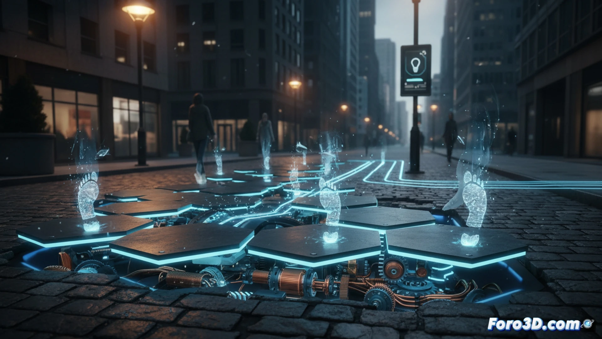
The process begins with 3D scanning of the target area using LiDAR or photogrammetry, capturing the exact topography and surrounding obstacles. In Blender, a parametric model of the Pavegen tiles is built, assigning each one a data node that receives signals from IoT pressure and voltage sensors. The key lies in Unity's logic: each tile becomes an interactive object that changes color based on accumulated energy. Footstep and watt generation data are transmitted via MQTT from the physical tiles to the twin, enabling simulation of pedestrian flow scenarios and prediction of structural wear through material fatigue algorithms.
Beyond efficiency: a social sensor for urban planning 🌍
Integrating Pavegen into a digital twin not only measures kilowatts but also reveals patterns of human behavior. By cross-referencing footstep data with the 3D model, urban planners can identify high pedestrian density zones, adjust LED lighting in real time, and redesign routes to maximize energy harvesting. This approach transforms each tile into a node of a living network, where predictive simulation anticipates maintenance needs before failures occur, closing the loop between pedestrian energy and public space sustainability.
How a Pavegen digital twin is integrated with urban management systems to optimize pedestrian flow and real-time energy generation
(PS: don't forget to update the digital twin, or your real twin will complain)