The recent three-day truce between Ukraine and Russia, backed by the United States, has failed in its goal of halting hostilities. Both sides accuse each other of violating the ceasefire, plunging the peace process into a paralysis of mistrust. In this context, 3D technology emerges as a key forensic tool to verify facts on the ground, offering a visual and impartial perspective beyond official statements.
3D Reconstruction of Damage and Ballistic Simulation 🛰️
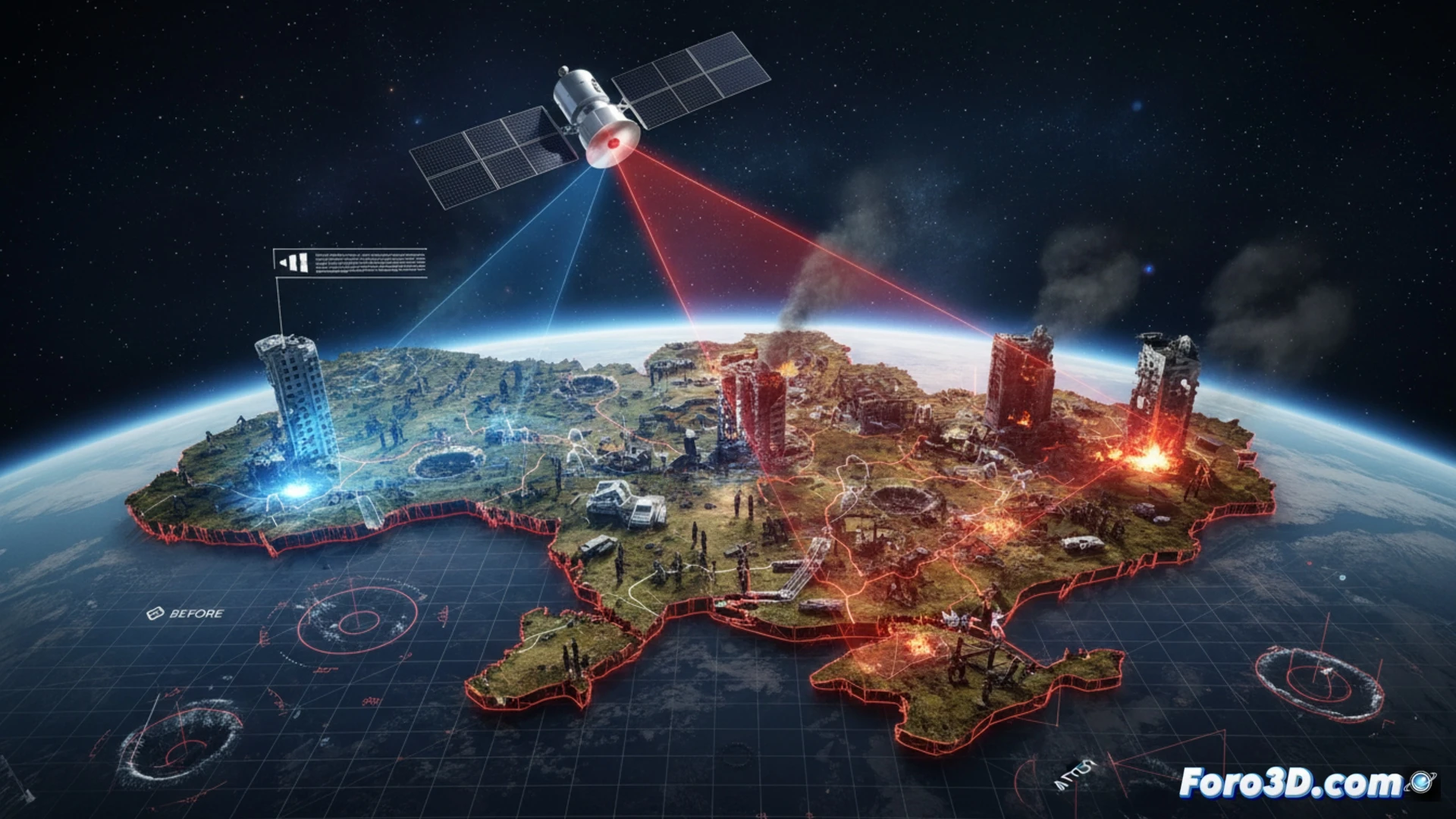
The technical analysis focuses on high-resolution satellite photogrammetry to model damaged civilian infrastructure, such as schools and hospitals, during the ceasefire period. By comparing pre- and post-attack 3D models, it is possible to calculate the volume of debris, the direction of impact, and the type of munition used. Simultaneously, ballistic simulations are conducted that recreate projectile trajectories from known military positions, allowing accusations of bombings to be contrasted with actual fire patterns. This methodology provides quantifiable data that challenges opposing political narratives.
The Fragility of Peace on a Vector Map 🕊️
The truce, conceived as a diplomatic breather, has become a mirror of the conflict's fragility. The mutual accusations are not mere propaganda tactics, but a reflection of a reality where every meter of the front line is monitored by drones and sensors. The 3D visualization of military positions and troop movements during the ceasefire demonstrates that, without an independent verification mechanism, any humanitarian pause is merely a parenthesis in a war that technology helps to document, but not to stop.
What photogrammetry techniques would you use to model conflict zones remotely?