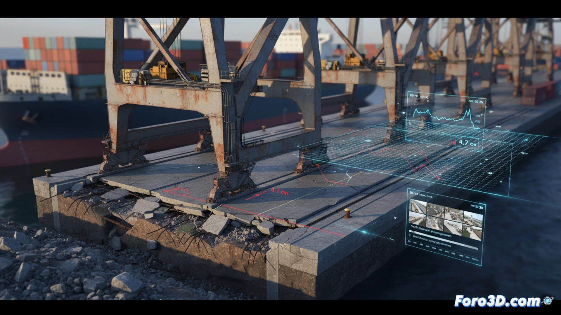
A state-of-the-art autonomous crane began unloading containers with a systematic positioning error of several centimeters. After ruling out mechanical and software failures, the engineering team turned to historical photogrammetry. By comparing point clouds generated with Pix4D over the last two years, a progressive sinking of the dock of 4.7 centimeters was identified in the crane's travel area, altering the machine's geometric calibration.
Workflow for subsidence detection in port infrastructure 🏗️
The process began with the alignment of historical digital surface models in Global Mapper, using fixed control points on distant buildings as a stable reference. The difference between the surfaces was exported as a deformation mesh to Civil 3D, where a subsidence heat map was generated. The analysis revealed that the sinking was not uniform but presented a gradient of 0.8 centimeters per meter towards the water's edge. This data was integrated into SketchUp to model the geometric impact on the crane's kinematics, demonstrating that the positioning error was a direct consequence of the change in the rail elevation.
Georeferenced digital twins as a predictive maintenance tool 🚁
This case demonstrates that periodic photogrammetry is not only useful for measuring volumes or generating plans, but also acts as an early warning system for structural deformations. A georeferenced digital twin, updated with monthly drone flights and processed in Pix4D, would have detected the sinking in its early stages. Integrating this data with autonomous machinery control systems would allow cranes to be dynamically recalibrated, avoiding unplanned downtime and ensuring precision in ship loading and unloading.
How can historical photogrammetry be integrated with real-time control systems to correct structural deviations affecting the calibration of autonomous cranes?
(PS: 3D surveying is like making a treasure map, but the treasure is an accurate model.)