In January 2026, a NASA satellite captured a luminescent anomaly off the coast of Argentina: a fleet of hundreds of Chinese fishing boats that were not fishing. This pattern is replicated in the South China Sea and the South Atlantic, where civilian vessels remain for weeks without extractive activity. Argentina and Taiwan face the same phenomenon, revealing a strategy by Beijing to project power without deploying military units, using the so-called maritime militia as a tool for geopolitical pressure and surveillance.
Satellite data modeling and interference simulation in EEZ 🛰️
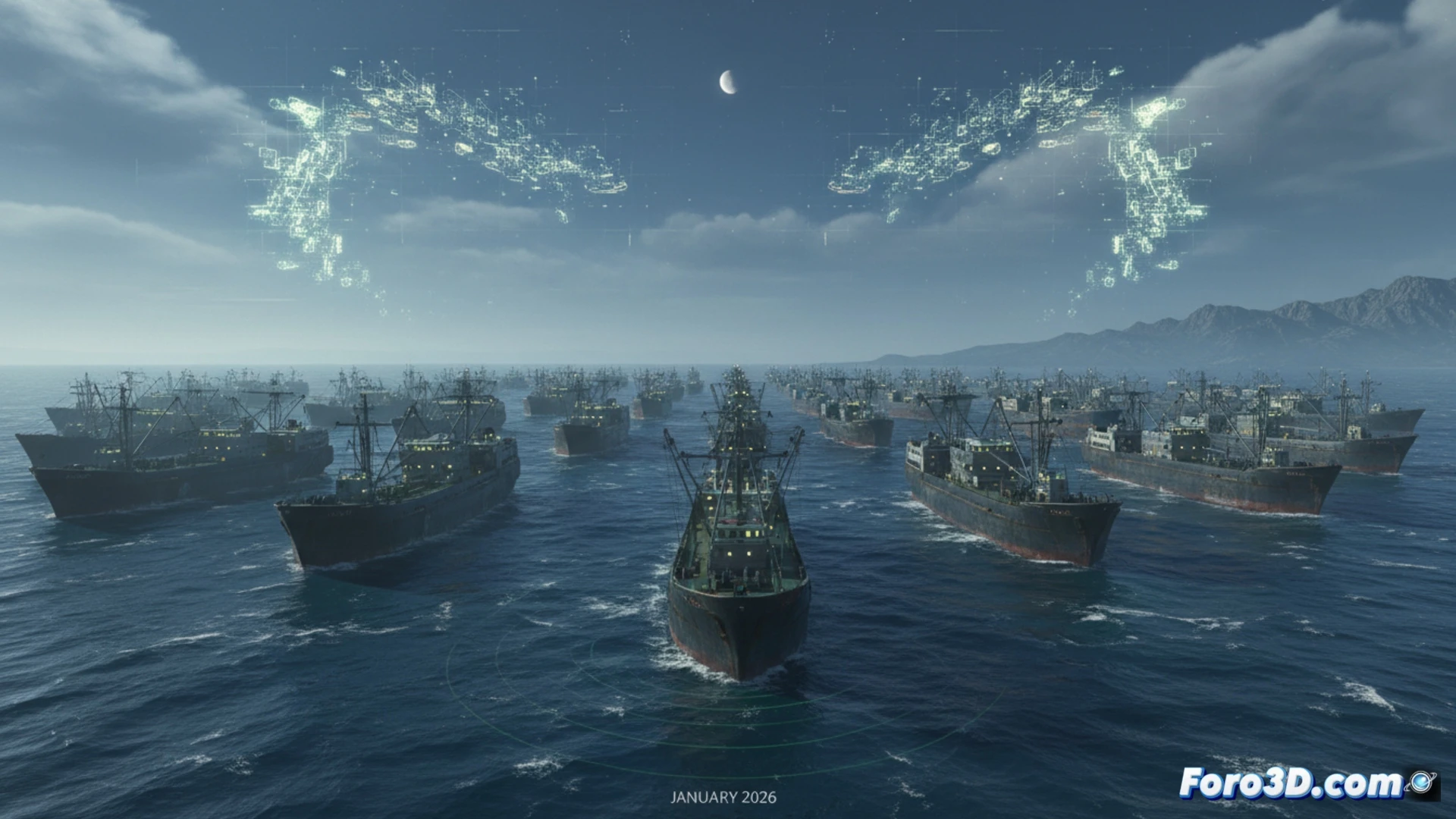
For this article, we have developed an interactive 3D visualization that integrates data from the Landsat program and AIS (Automatic Identification System) to map the exact position of these vessels off the Argentine and Taiwanese Exclusive Economic Zones. The scene overlays strategic maritime routes, such as the Drake Passage and the Taiwan Strait, with heat maps showing the density of the Chinese fleet. The simulation allows the user to rotate the camera and observe how the static presence of these ships virtually blocks commercial traffic, generating real-time bottlenecks. Additionally, a subsidy analysis module is included, where each luminous point represents a state-funded vessel, drawing connection lines to base ports in China.
The professionalization of the civilian fleet as a hybrid threat ⚠️
What is unsettling is not just the number of ships, but the evidence that China is professionalizing this militia. Taiwan has already adapted its patrol boats to carry anti-ship missiles after detecting Chinese research vessels conducting suspicious operations. Argentina observes the same pattern: vessels occupying strategic sea areas, without fishing, but with the capacity to intercept communications and map the seabed. Our visualization concludes that this strategy of silent pressure redefines the concept of maritime sovereignty, where a fishing boat can be as effective as a destroyer in consolidating presence and deterring competitors.
What key data about the Chinese ghost fleet, such as its spatial arrangement and navigation patterns, can satellite 3D visualizations reveal about the control of strategic maritime routes and geopolitical pressure on the global supply chain?
(PS: visualizing the global supply chain is like following a trail of breadcrumbs... in 3D)