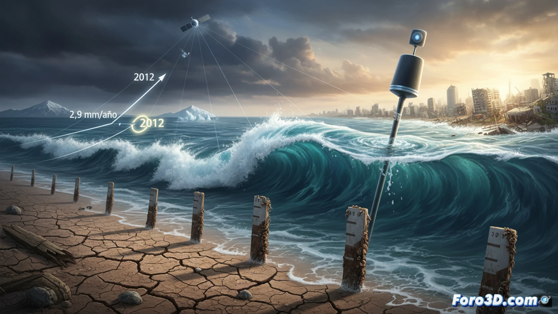
A new study based on satellite measurements confirms an abrupt jump in the global rate of sea level rise. Around 2012, the speed went from 2.9 to 4.1 millimeters per year, a change that remains stable. This increase, which adds up to more than 0.2 meters in 15 years, could be due to both natural variability and the acceleration of global warming.
Satellites and models: the technology behind precise measurement 🌊
The data comes from radar altimeters aboard satellites such as Jason-3 and Sentinel-6, which measure the distance to the ocean with millimeter precision. These sensors, combined with GPS buoys and gravitational models, make it possible to distinguish between glacier melt, thermal expansion of water, and changes in terrestrial storage. The time series, corrected for effects such as post-glacial rebound, shows a clear statistical break in 2012, forcing a revision of coastal flooding projections.
Spoiler: fish won't need visas yet 🐟
At this rate, by the time you finish reading this, the sea will have risen by the thickness of a sheet of paper. Don't worry: coastal cities won't turn into Venice tomorrow, but perhaps by 2100. However, if you have a beachfront apartment, it might be a good time to review your insurance policy or start making friends with a boat. Water doesn't ask for permission.