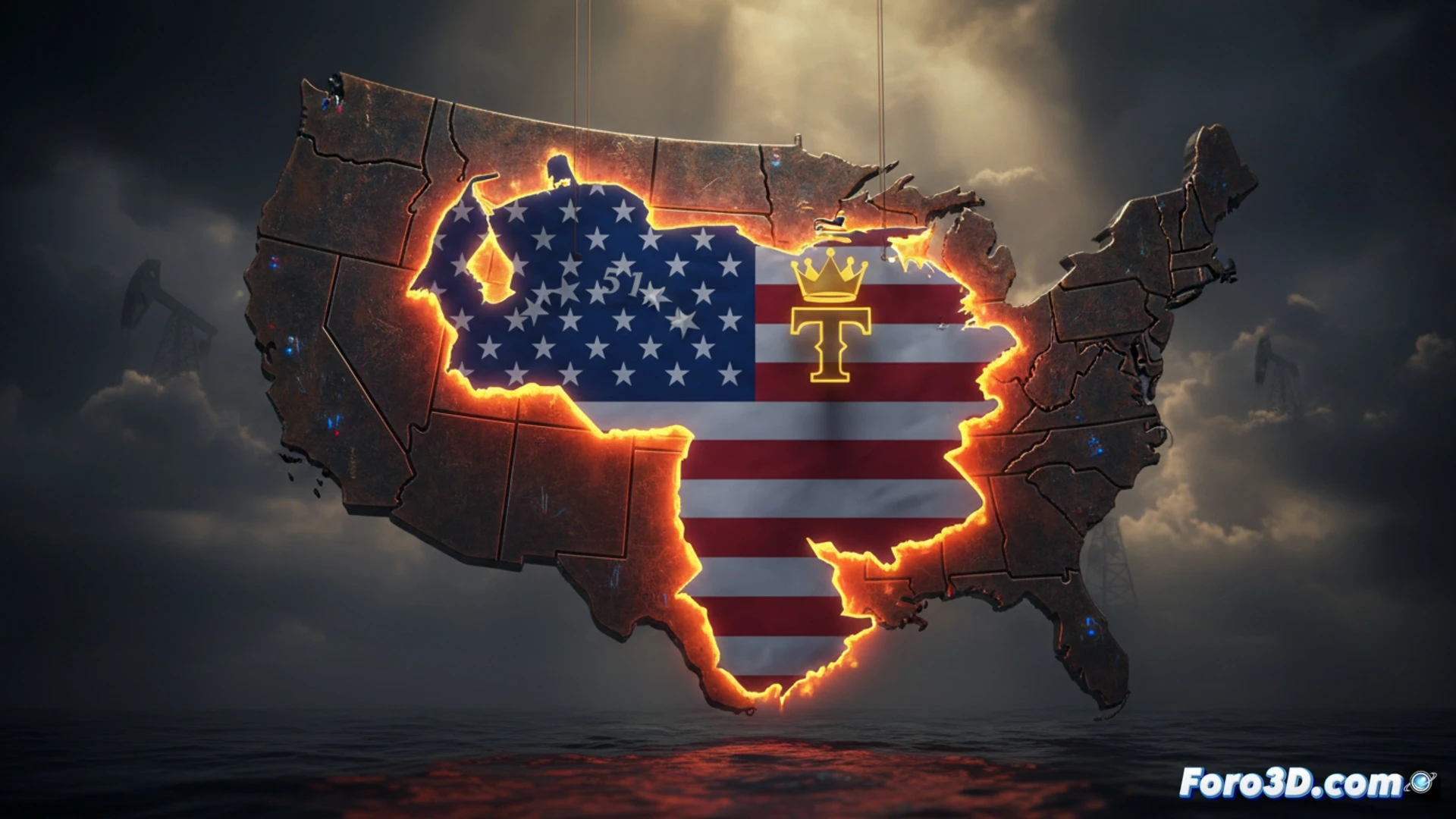
President Donald Trump's recent social media post, featuring a map of Venezuela colored with the US flag and labeled 51st state, constitutes an act of political communication that transcends text. This image, devoid of words, operates as a powerful visual propaganda artifact. From a technical analysis standpoint, the chromatic overlay and the absence of verbal context seek to install a narrative of territorial possession, leveraging the strategic value of Venezuelan oil resources.
3D Reconstruction and Visual Manipulation Detection 🛠️
For a rigorous study, it is possible to reconstruct the original map in a 3D environment using modeling software such as Blender or GIS. The first step is to isolate the geographic silhouette of Venezuela and project the US flag texture onto it. Through color histogram analysis and edge detection, one can verify whether the overlay is clean or if there are alterations in territorial boundaries, such as the inclusion of disputed regions (like the Esequibo). The absence of text forces an analysis of color psychology: red, white, and blue not only represent the US but also symbolically erase Venezuelan national identity. Additionally, the lighting and shadows on the map allow simulation of how the image was rendered to maximize its visual impact on mobile screens, where the contrast between the background and the territorial shape reinforces the idea of annexation.
The Power of Graphic Silence in Digital Geopolitics 🧠
Trump's decision to include no text whatsoever is a calculated non-verbal communication strategy. By eliminating the need for reading, the image becomes universal and instantaneous, while also avoiding the responsibility of an official statement. This type of visual propaganda, analyzable through computer vision, demonstrates how a simple map can function as a performative act of sovereignty. The repetition of this idea, from sports contexts to military ones, turns the map into an icon that seeks to normalize a geopolitical reality that, although fictitious, is planted in the collective imagination through visual repetition.
How the illusion of territorial annexation is constructed in Trump's 3D map and what visual propaganda techniques it uses to symbolically legitimize intervention in Venezuela
(PS: visualizing political lies in 3D is easy; the hard part is fitting so many simultaneously)