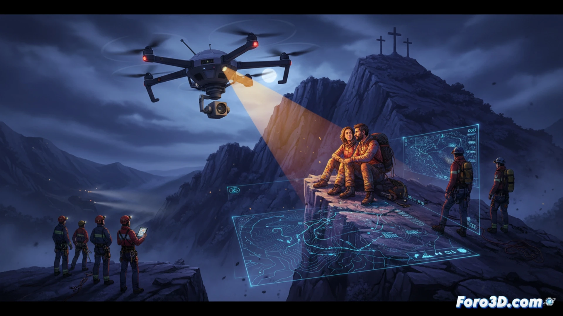
Last night, a couple was rescued on the mountain of Les Tres Creus, in Tavernes de la Valldigna, after becoming trapped on a steep slope with no way down. The operation, coordinated by the Local Police, Civil Protection, and the Firefighters Consortium, faced complex terrain and total darkness. The key to success was the use of a drone to locate and guide the affected individuals, demonstrating how 3D technology and night vision can overcome the limitations of traditional search methods.
Technical analysis of the operation with drones and 3D mapping 🚁
The lack of sunlight prevented the requested helicopter from taking off, leaving the weight of the rescue on ground patrols and the drone deployed by an agent. While three police patrols scoured the area, the drone performed an aerial reconnaissance that allowed real-time mapping of the steep slope area. This improvised 3D mapping offered constant visual guidance to the couple, conveying calm and pointing out a safe path. Compared to traditional searches, which rely on flashlights and shouts, the drone reduced location times and minimized the risk of falls for rescuers on terrain where every meter counts.
3D simulation to prevent future mountain emergencies ⛰️
This incident highlights the potential of 3D simulation technologies for planning evacuation routes in complex terrain environments. Tools such as digital terrain modeling and augmented reality could be integrated into Civil Protection protocols to predict blind spots and nighttime risk zones. If the couple had had access to an app with updated 3D maps and drone guidance, they might have avoided the fatal slope. The lesson is clear: investing in simulation and drones not only saves lives but transforms mountain disaster management.
What emergency protocols are activated in a nighttime drone rescue when rough terrain and reduced visibility compromise the battery life of the equipment?
(PS: Simulating disasters is fun until the computer crashes and you are the disaster.)