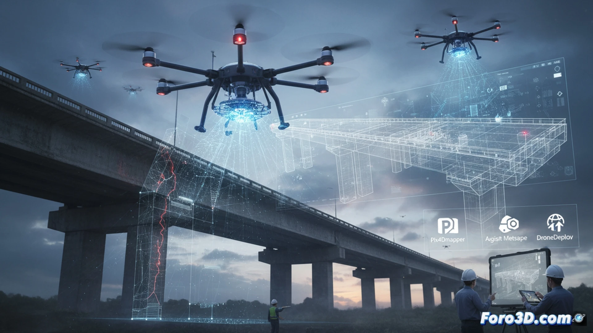
3D technology takes a leap into the drone operator's craft. You no longer just fly and record; now you can reconstruct terrain, generate volumetric models, and measure with millimeter precision. A clear example is bridge inspection: the drone captures images and the 3D software creates a digital copy to detect cracks without risks. Key programs: Pix4Dmapper, Agisoft Metashape, and DroneDeploy.
From flight to model: the 3D workflow 🚁
The process is simple in theory, dense in practice. You fly a programmed route, the drone fires hundreds of overlapping photos. Then the software processes them using photogrammetry, generating point clouds and textured meshes. With a program like RealityCapture or Meshroom you get a model exportable to CAD or BIM. This allows surveyors, architects, and farmers to make decisions based on real data, not assumptions.
When the drone thinks it's a digital sculptor 🎨
The best part is that now the drone doesn't just scare away pigeons or record weddings. Now you can say you're a digital sculptor without touching a chisel. Of course, get ready for your computer to smoke processing 500 photos. And watch out: if the wind moves your drone half a meter, the 3D model will look like a Picasso painting. But hey, the client pays for it anyway if you add an artistic filter.