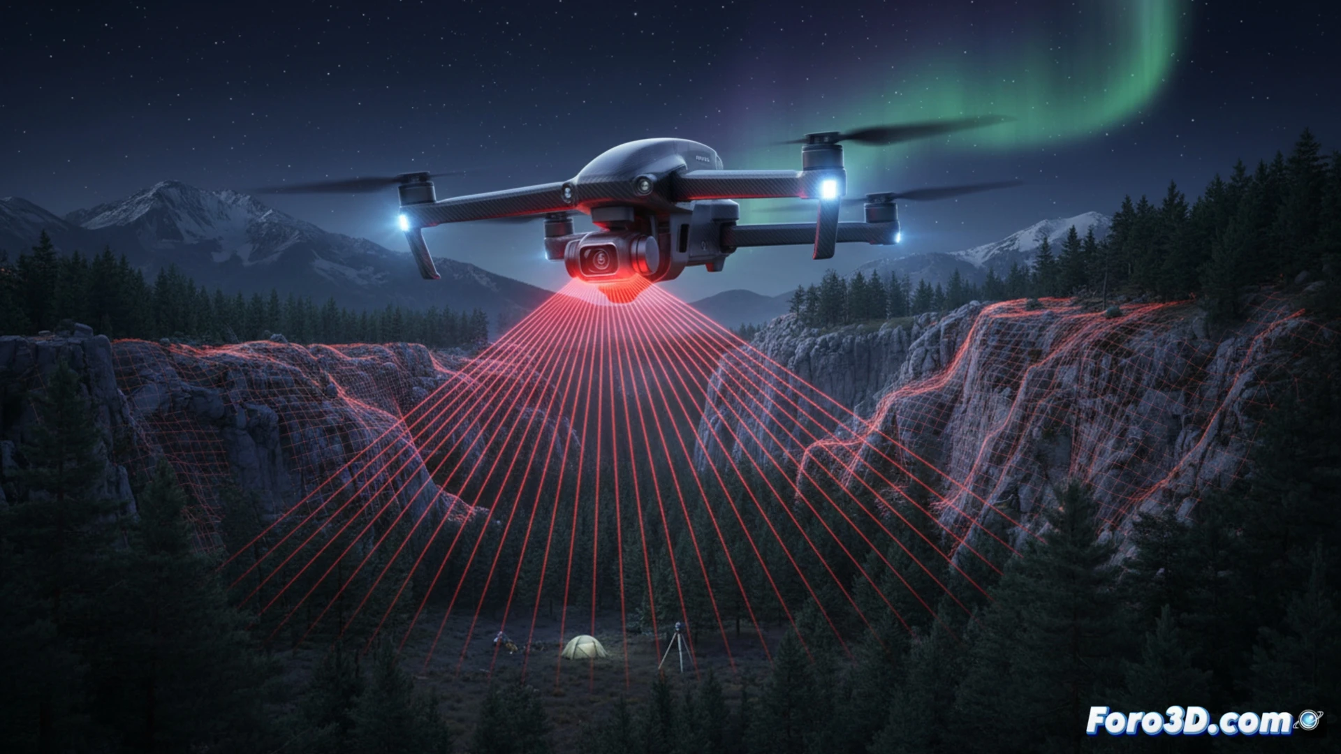
The DJI Air 3S enters the geomatics market with a LiDAR navigation system that redefines data capture in low-light environments. Its ability to detect small obstacles in total darkness, combining front-facing LiDAR sensors with hybrid computer vision, allows surveyors to conduct nighttime surveys without collision risk. This eliminates dependence on sunlight and expands operational windows for critical projects.
Hybrid precision in extreme conditions 🌙
The Air 3S system uses a hybrid approach that fuses data from the proprietary LiDAR with computer vision algorithms to generate point clouds in real time. Unlike traditional methods based on total stations or GNSS, which require artificial lighting or visible control points, this drone can map complex terrain, such as tunnels or urban canyons, without interruptions. Integration with DJI Fly allows scanning parameters to be adjusted on the fly, optimizing point density in shadowed areas. For infrastructure inspections such as bridges or power towers, detecting thin branches or cables in the dark significantly reduces interpolation errors in 3D models.
The end of light limitation in the field 🚀
This technological advance forces a rethinking of traditional workflows in surveying. If night was once dead time for data capture, it now becomes an opportunity to avoid pedestrian traffic or excessive solar radiation. The precision of the hybrid LiDAR directly competes with terrestrial scanners under controlled conditions, but with the advantage of aerial mobility. The real change is not just in the hardware, but in the autonomy to decide when and where to measure, without depending on the diurnal cycle.
How does the integration of a nighttime LiDAR system like the DJI Air 3S affect the accuracy of digital elevation models compared to traditional daytime surveying methods?
(PS: 3D surveying is like making a treasure map, but the treasure is an accurate model.)