Cryoseisms, or frost quakes, are winter phenomena that generate loud noises and cracks in the ground without tectonic activity. They occur when groundwater freezes rapidly, expanding and fracturing the frozen terrain. They are often mistaken for real earthquakes, causing alarm in populations in extreme climates. Understanding their mechanics is crucial for disaster management, and 3D modeling offers precise tools for their study and prediction.
Fracture modeling with VGSTUDIO MAX and COMSOL 🧊
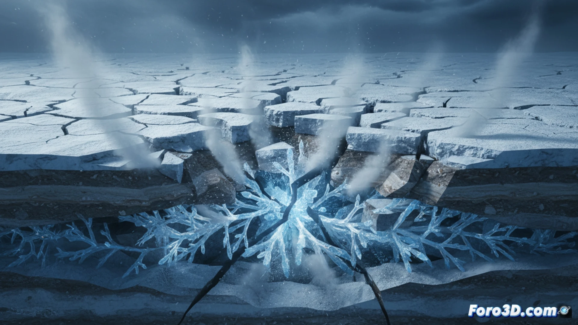
Simulating a cryoseism requires two complementary approaches. First, with Volume Graphics VGSTUDIO MAX, subsurface tomographies are processed to generate a detailed 3D model of pores, fissures, and ice layers. This volumetric mesh is imported into COMSOL Multiphysics, where the bio-electromagnetism module is applied to simulate heat transfer and the phase change of water. By modeling the volumetric expansion of ice (approximately 9%), the software calculates internal stresses that exceed the soil's strength, visualizing crack propagation in real time. Materialise Mimics complements the process by segmenting heterogeneous geological tissues, allowing the isolation of permafrost layers or areas of high water saturation for localized risk analysis.
Disaster prevention and differentiation 🌍
In regions like Canada or Scandinavia, cryoseisms have triggered seismographs and social alarms. 3D simulation allows them to be differentiated from tectonic earthquakes by analyzing the shock wave signature (low frequency and short duration) and the superficial location of the fractures. Predicting these risk zones using VGSTUDIO MAX models helps prevent damage to critical infrastructure such as gas pipelines or foundations. By integrating historical climate data into COMSOL, engineers can anticipate the likelihood of cryoseisms, transforming a confusing phenomenon into a controllable variable within urban planning in cold climates.
Would you export the results to GIS format?