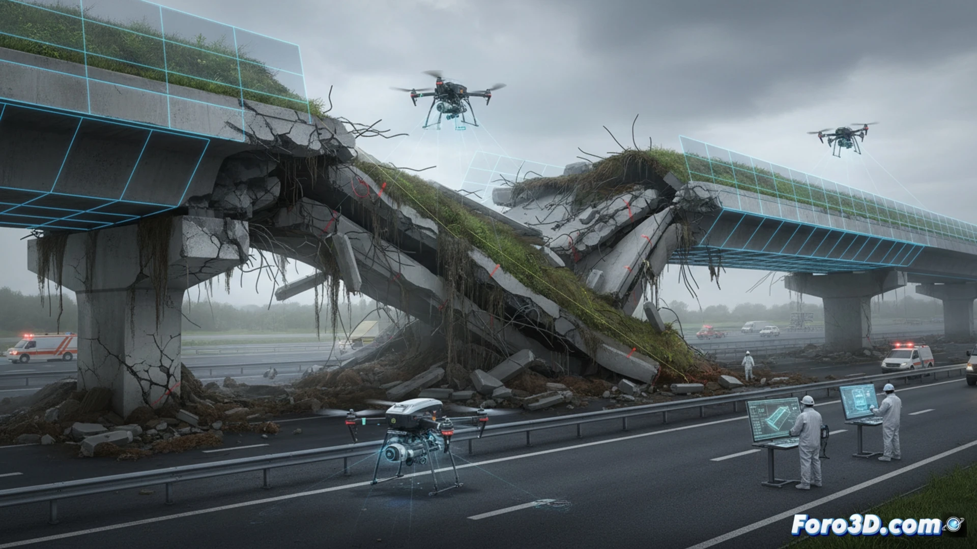
The collapse of a wildlife crossing over a highway has opened a structural forensic investigation. The main hypothesis points to a bearing capacity failure, possibly triggered by soil water saturation. To verify this scenario, the forensic team has implemented a workflow that combines massive data capture with drones and parametric modeling in specialized software, aiming to recreate the exact loading conditions prior to the collapse.
Forensic Workflow: From Drone to Finite Element Model 🛠️
The process begins with a programmed drone flight to capture hundreds of high-resolution images of the collapsed wildlife crossing and its surroundings. These images are processed in Bentley ContextCapture to generate a dense point cloud and a textured 3D model of the terrain and structural remains. From this model, the precise geometry of the soil and vegetation layer that supported the crossing is extracted. This geometry is imported into SAP2000, where the distribution of dead and live loads is calculated. In parallel, Civil 3D is used to model the natural terrain profile and evaluate surface hydrology, determining the volume of absorbed water. The analysis in SAP2000 seeks to establish whether the weight of the saturated soil exceeded the bearing capacity of the foundation soil, causing the collapse due to base failure.
Lessons for Green Infrastructure Design 🌿
This case demonstrates that drone photogrammetry has become an indispensable tool for forensic engineering, allowing a detailed virtual reconstruction without exposing personnel to risks. The integration of water saturation data with finite element models reveals the need to design wildlife crossings considering extreme climate scenarios. The use of Blender for the final visualization of the model helps to clearly communicate technical conclusions to maintenance teams, underscoring that the safety of these structures depends as much on their design as on soil drainage management.
How can drone photogrammetry differentiate between a progressive structural failure and a specific manufacturing defect in the forensic analysis of a wildlife crossing collapse?
(PS: Simulating a collapse is easy. The hard part is not crashing the program.)