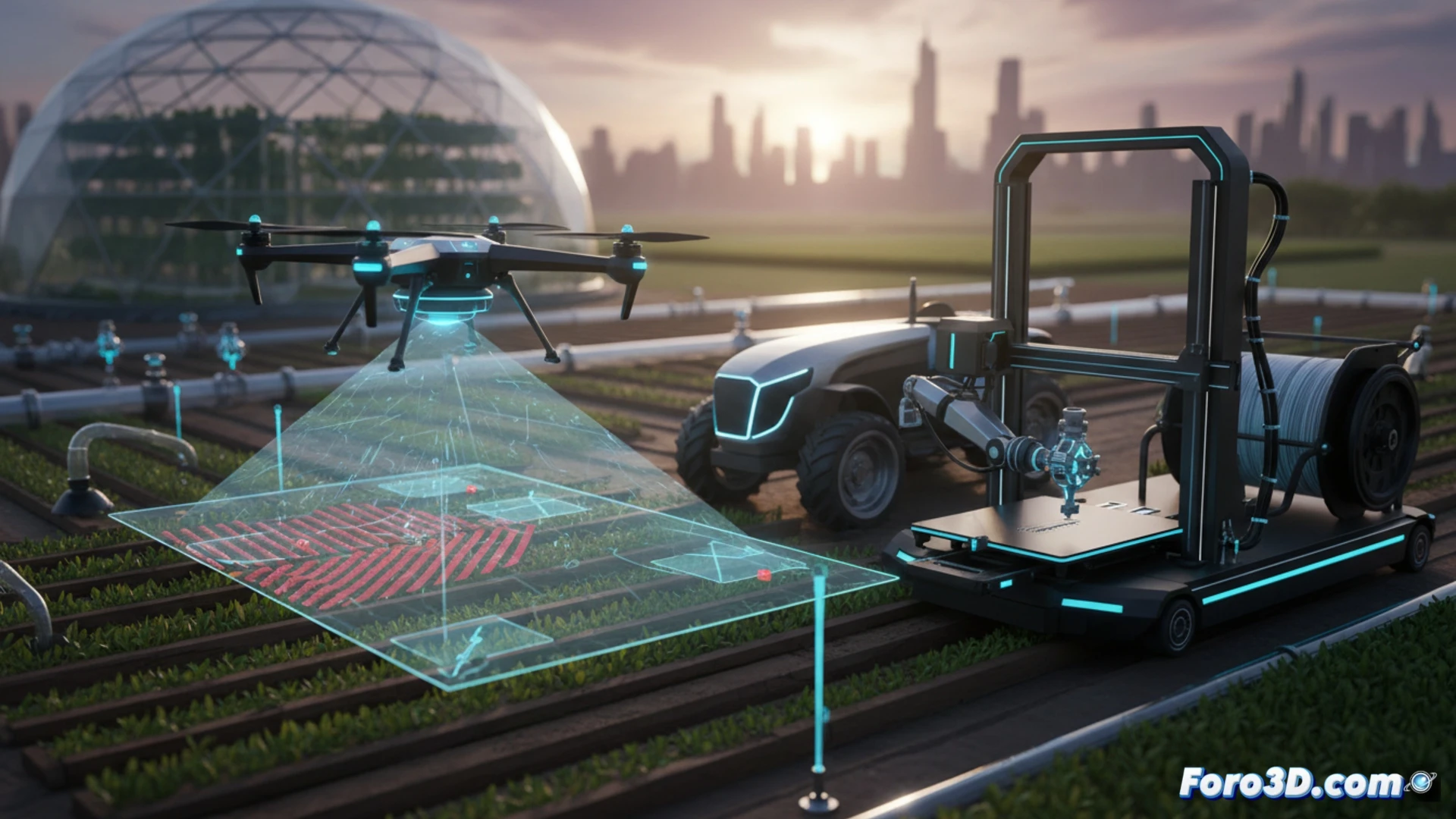
3D technology is not only used to manufacture plastic parts or create miniatures. In the field, it allows farmers to optimize resources and reduce costs. For example, a farmer can scan the terrain with a drone and generate a three-dimensional model to identify areas with poor irrigation or emerging pests. Then, they print spare parts for tractors or localized irrigation systems, avoiding weeks of waiting for a shipment.
Programs and workflow for the digital farmer 🌾
To start, you need a drone with a camera (like a DJI Phantom) and photogrammetry software such as Agisoft Metashape or Pix4Dfields. These programs convert aerial photos into a 3D model of the crop. Then, tools like QGIS analyze plant health using NDVI indices. For 3D printing, programs like Fusion 360 or Tinkercad allow you to design pipe adapters or sensor mounts. The process is straightforward: capture data, process it on a PC, and send the STL file to a printer like the Creality Ender 3.
When the tractor laughs at your patience 🚜
Of course, it all sounds very nice until your drone decides to crash into the only century-old tree in the field. Or worse: you print a part for the irrigation system, install it, and discover that the plastic melts in the August sun. Then you go back to the traditional method: wire, electrical tape, and a few curses to the wind. But hey, at least the 3D model of your plot looks nice on the tablet while you wait for the technician.