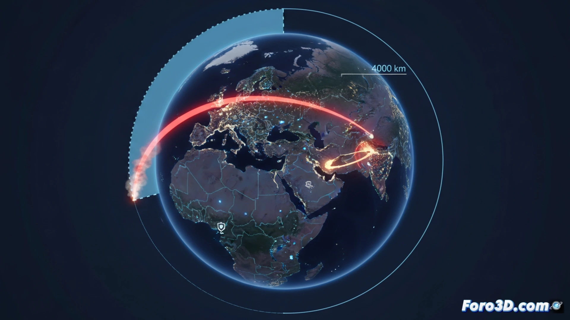
The recent Iranian missile attack on the Diego García military base, although failed, has provided crucial strategic data. The confirmation of a range of 4000 kilometers redefines the threat map, placing numerous European capitals within direct action radius. This scenario is ideal for analysis using 3D technologies, which allow transcending flat maps and offering a deep and tangible spatial understanding of the deployed military capabilities.
Geospatial Reconstruction: From Trajectory to Threat Map 🎯
A modeling project for this event would be structured in three layers. First, a 3D reconstruction of the Diego García base, with its key infrastructures, using satellite data. Second, a simulation of the hypothetical ballistic trajectory of the missile, starting from a point in Iran and considering physical parameters, to visualize its arc and failed impact point. The final and most impactful layer would be an interactive range map: a great geospatial circle of 4000 km radius centered on Iran, modeled in 3D on the globe, which would dramatically illuminate all European capitals within that perimeter, such as Rome, Paris, or Berlin.
Beyond the Model: Information as Deterrence ⚖️
The power of this visualization is not only technical, but analytical. An integrated 3D model turns scattered data into an immediate spatial narrative. Seeing the sphere of influence projected over Europe makes the abstract threat concrete. These tools are vital for strategic evaluation and public communication of risks, demonstrating that, in the era of long-range missiles, geospatial understanding is an essential component of security and deterrence.
How can 3D modeling and GIS (Geographic Information Systems) analysis reveal real vulnerabilities and possible successful impact points in a facility like Diego García, based on the trajectory and data from the failed missile?
(P.S.: 3D war maps are like renders: the more realistic, the more time you need to process them)