The recent intensification of drone attacks in the Persian Gulf is not just a headline. It represents a complex scenario where geography, technology, and tactics converge. In our niche, we translate this event into a three-dimensional analytical space. Using modeling and simulation technologies, we can break down the offensive, going beyond the news to understand its spatial development, the real capabilities of the weaponry, and the strategic impact at a critical point for the global economy like the Strait of Hormuz.
3D Terrain Reconstruction and Trajectory Simulation 🗺️
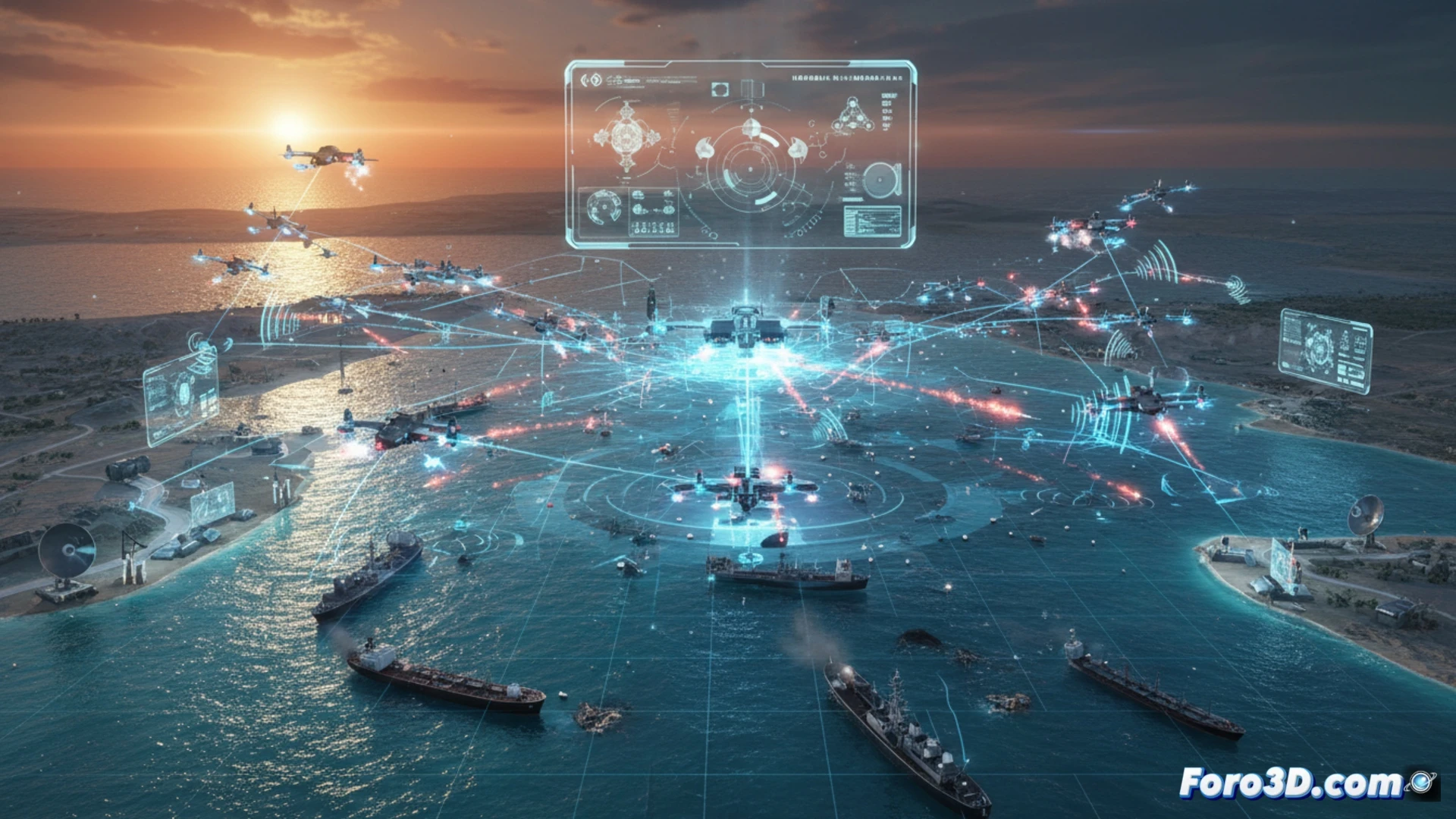
The first step is to create an accurate geospatial model of the area. By integrating bathymetric and topographic data into a Geographic Information System (GIS), we generate a faithful 3D environment of the Strait of Hormuz and its coasts. Over this model, we can simulate the drones' trajectories. By importing their technical specifications (range, speed, flight ceiling) into a simulation engine, we trace probable routes from hypothetical launch points to their targets. This allows visualizing air corridors, risk zones, and blind spots in detection systems. Additionally, 3D modeling of the drones and target vessels helps analyze approach angles and specific vulnerabilities.
From Tactical Model to Interactive Geopolitical Analysis 🧩
The true power of 3D analysis emerges when converting these simulations into interactive tools. A 3D map that allows activating information layers (real-time maritime traffic, coastal battery ranges, exclusive economic zones) transforms the understanding of the conflict. It stops being a succession of isolated attacks to reveal itself as a spatial strategy aimed at projecting power and exerting coercion over a vital maritime space. This technical visualization becomes the definitive bridge between the tactical event and its profound geopolitical and economic implications.
How can 3D modeling and spatial simulation help unravel the routes, capabilities, and blind spots in the drone offensive in the Persian Gulf?
(P.S.: virtually reconstructing is the first step to reconstructing in reality)