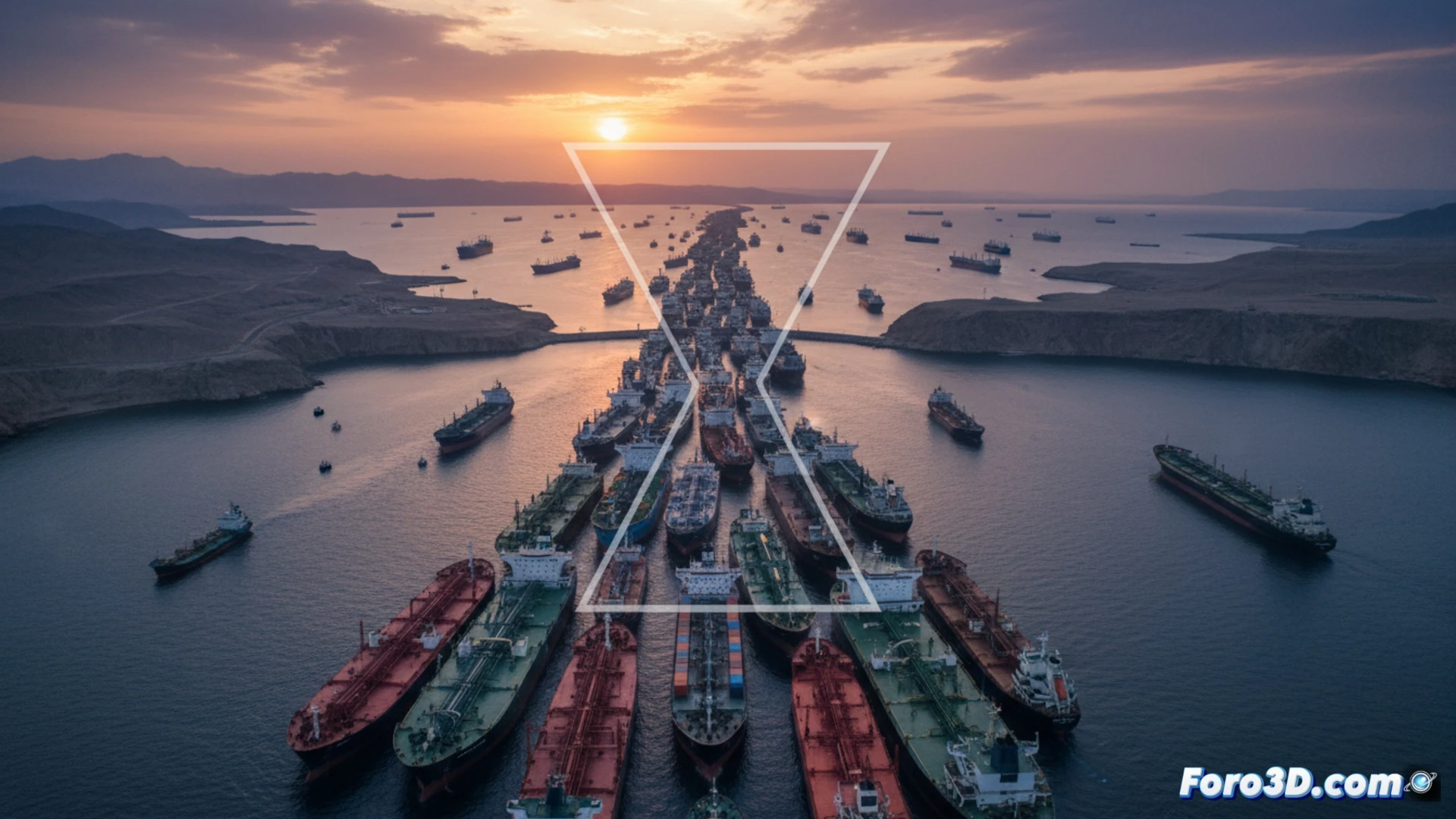
The economic stability of the Gulf states, despite their advances in diversification, remains tied to a maritime artery just 39 kilometers wide: the Strait of Hormuz. Through this passage flows nearly 30% of the oil traded by sea and it is the critical route for 85% of the region's food imports. A blockade, an attack, or a military escalation that interrupts this traffic would not only choke hydrocarbon exports but would trigger an internal supply crisis in a matter of days, jeopardizing decades of development.
3D Modeling of Flows and Simulation of Critical Disruptions 🛢️
3D visualization becomes an indispensable tool for understanding this vulnerability. A detailed, georeferenced, real-time model of the route would allow mapping the density of tanker and general cargo ship traffic. The power of modeling lies in scenario simulation: by introducing a virtual blockade point in the strait, the immediate collapse in crude oil outflow and the backlog of ships with food can be visualized. This simulation would quantify the impact hour by hour, showing how origin ports would saturate and how food reserve indicators in destination countries would rapidly enter the red zone.
Beyond Oil: The Geopolitics of Dependence 🗺️
The 3D modeling exercise reveals an uncomfortable truth: economic diversification has not yet achieved logistical autonomy. The hyperdependence on a single route for essentials, energy, and food constitutes a systemic risk. An interactive risk map based on these simulations not only illustrates the Gulf's exposure but evidences how a geographical bottleneck becomes a global crisis multiplier. Regional stability therefore depends as much on economic policies as on maritime security in a strait that is, literally, the lifeline.
What tool would you use to create an interactive geopolitical risk map?