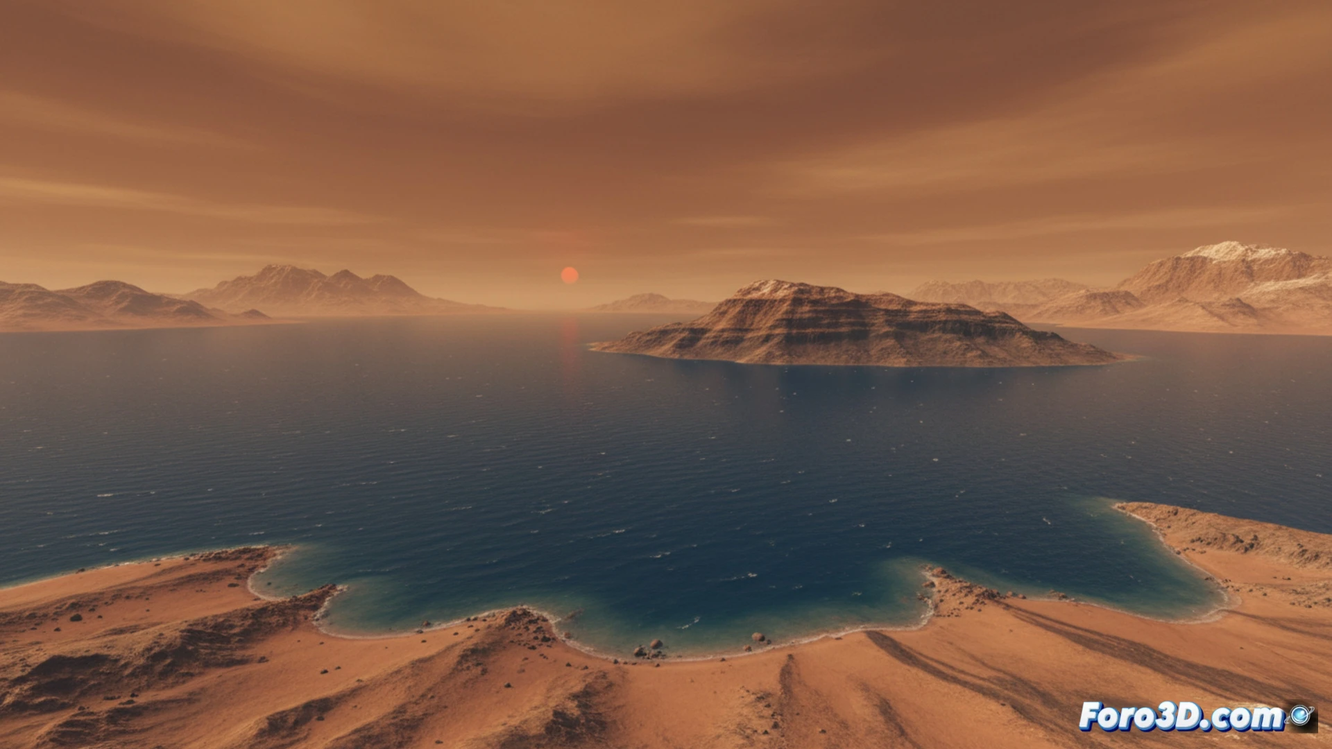
The history of water on Mars is a first-rate scientific puzzle. The data indicate that the red planet hosted a vast ocean, but the calculations about its disappearance don't add up. A huge amount of water, equivalent to a global ocean more than 200 meters deep, seems to have vanished without leaving a proportional trace. This planetary mystery is the perfect candidate to be addressed and communicated through 3D scientific visualization techniques, transforming complex data into comprehensible visual narratives. 🔍
3D Modeling to Unravel Planetary Processes 🪐
3D visualization tools allow reconstructing the Noachian Mars with unprecedented detail. We can generate interactive models of the hypothetical global ocean, overlaying estimated bathymetries on the current topography. Beyond the static, the true power lies in simulating and visualizing the different loss processes: erosion from brief hydrological cycles, ice sublimation, or atmospheric escape. Contrasting these visual simulations with 3D maps of hydrated minerals and current ice deposits helps researchers evaluate which scenario best fits the observable geological evidence, making the abstract tangible.
From Data to Outreach: A Visual Story 🌉
This enigma is not just for scientists. Scientific visualization serves as a fundamental bridge for outreach. An interactive 3D model showing the progressive disappearance of the ocean, or comparing the amount of water lost with that retained, communicates the magnitude of the problem in an intuitive and impactful way. By transforming complex theories and discrepant data into a visual experience, it fosters public understanding and underscores how 3D technology is today an indispensable tool for planetary science.
How is 3D visualization of orbital and geological data unveiling the chronology and fate of Mars' ancient oceans?
(P.S.: modeling manta rays is easy, the hard part is making them not look like floating plastic bags)