The economic barrier of high-precision professional LiDAR has just collapsed. The Raven series is presented as a modular spatial scanning system that reduces the entry cost to approximately 2000 dollars. This advancement is not just an incremental improvement, but a paradigm shift that puts the ability to capture 3D environments with millimeter precision within reach of architecture studios, archaeology teams, surveyors, and heritage conservators, radically democratizing access to this technology. 🚀
Technical specifications and modular design for open workflows 🔧
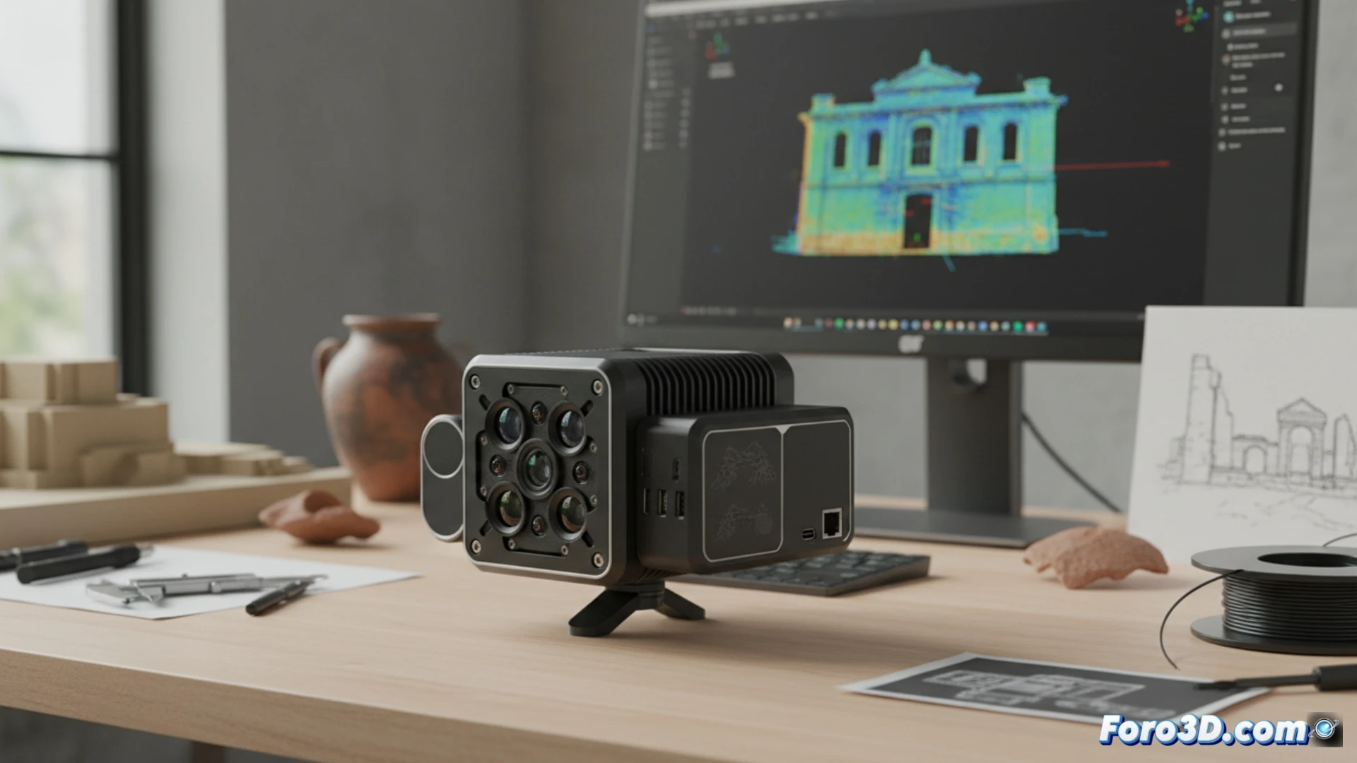
The heart of the Raven series lies in its functional design and open-source philosophy. The system offers the range and precision of professional equipment that multiplies its cost. Its modular architecture allows adapting the sensor to different platforms, such as tripods or vehicles, for terrestrial or mobile campaigns. Additionally, it integrates natively with open-source geospatial data processing software, ensuring a complete, transparent workflow without recurring license costs. This gives the professional total control, from capture to the generation of point clouds and digital models.
A turning point for geomatics and heritage documentation 📜
The arrival of Raven marks a before and after. It will no longer be necessary to have large budgets to faithfully digitize an archaeological site, monitor a construction project, document a historic building, or model complex terrain. By drastically lowering the initial investment, this tool fosters innovation and allows more spatial documentation and analysis projects to become reality. Raven is not just a sensor; it is a catalyst for digital preservation and accessible study of our physical environment.
Can the low-cost LiDAR from the Raven series compete in precision and workflow with traditional professional topographic solutions in geomatics projects?
(P.S.: 3D surveying is like making a treasure map, but the treasure is an accurate model.)